Area Overview for DE13 8JP
Photos of DE13 8JP

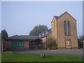
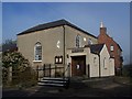
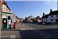
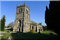
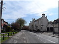
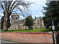
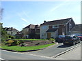
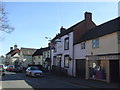
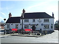
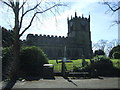
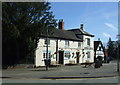
76 photos from this area
Area Information
Key information about the DE13 8JP including its size, population, and administrative classification.
- Area Type
- Postcode
- Area Size
- 1.9 hectares
- Population
- 1389
- Population Density
- 3063 people/km²
House Prices in DE13 8JP
42
Properties
£235,174
Average Sold Price
£69,950
Lowest Price
£599,950
Highest Price
Showing 42 properties
| Address | Type | Beds | Baths | Last Sale Price | Last Sale Date | |
|---|---|---|---|---|---|---|
| Orchard House, Westmead Road, Barton Under Needwood, DE13 8JP | Bungalow | - | - | £599,950 | Aug 2025 | |
| 10 Westmead Road, Barton Under Needwood, DE13 8JP | Bungalow | 2 | 1 | £320,000 | Jul 2025 | |
| 31 Westmead Road, Barton Under Needwood, DE13 8JP | Semi-detached | 4 | 3 | £420,000 | Jul 2024 | |
| 33 Westmead Road, Barton Under Needwood, DE13 8JP | house | - | - | £400,000 | Feb 2023 | |
| 7 Westmead Road, Barton Under Needwood, DE13 8JP | Semi-detached | 2 | 1 | £230,000 | Jun 2022 | |
| 5 Westmead Road, Barton Under Needwood, DE13 8JP | Bungalow | - | - | £286,000 | Feb 2022 | |
| 22 Westmead Road, Barton Under Needwood, DE13 8JP | Semi-detached | 4 | 1 | £375,000 | Aug 2021 | |
| 17 Westmead Road, Barton Under Needwood, DE13 8JP | house | 4 | - | £249,950 | Aug 2018 | |
| 47 Westmead Road, Barton Under Needwood, DE13 8JP | Bungalow | - | - | £215,000 | Nov 2017 | |
| 20 Westmead Road, Barton Under Needwood, DE13 8JP | Bungalow | - | - | £220,000 | Jun 2016 |
Page 1 of 5
Energy Efficiency in DE13 8JP
Amenities
Schools
| Rank | School | Type | Entry gender | Ages |
|---|
Explore more schools in this area
Go to Schools tabDemographics
Household Size
Two person
most common
Accommodation Type
Houses
most common
Tenure
88
majority
Ethnic Group
White
most common
Religion
N/A
most common
Household Composition
N/A
most common
Age
47
median
Adults (30-64 years)
most common
Household Deprivation
N/A
with no deprivation
NS-SEC
38
in Lower managerial occupations
Explore more demographic insights in this area
Go to Demographics tabPlanning
Planning Constraints
- Flood RiskPremium
- Ramsar Wetland SitesPremium
- Area of Outstanding Natural BeautyPremium
- Protected Nature ReservePremium
- Protected WoodlandPremium