Area Overview for DE13 7JZ
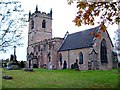
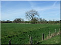
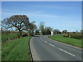
Photos of DE13 7JZ
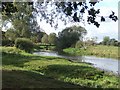
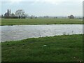
![Flooding in the Trent valley, King's Bromley [1] in DE13 7JZ](https://images.propbar.co.uk/images/geograph/67/35/6735586_120.jpg)
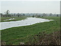
![Receding flood, Trent valley, King's Bromley [1] in DE13 7JZ](https://images.propbar.co.uk/images/geograph/67/45/6745006_120.jpg)
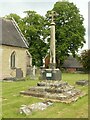
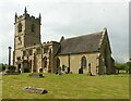
20 photos from this area
Area Information
Key information about the DE13 7JZ including its size, population, and administrative classification.
- Area Type
- Postcode
- Area Size
- 4.5 hectares
- Population
- 1694
- Population Density
- 53 people/km²
House Prices in DE13 7JZ
4
Properties
£419,375
Average Sold Price
£375,000
Lowest Price
£502,500
Highest Price
Showing 4 properties
| Address | Type | Beds | Baths | Last Sale Price | Last Sale Date | |
|---|---|---|---|---|---|---|
| 3, Church Farm Mews, Church Lane, Kings Bromley, Burton Upon Trent, DE13 7JZ | Semi-detached | - | - | £502,500 | Jan 2018 | |
| 1, Church Farm Mews, Church Lane, Kings Bromley, Burton Upon Trent, DE13 7JZ | Semi-detached | 4 | - | £375,000 | Sep 2013 | |
| 2, Church Farm Mews, Church Lane, Kings Bromley, Burton Upon Trent, DE13 7JZ | house | 4 | - | £380,000 | Nov 2012 | |
| 4, Church Farm Mews, Church Lane, Kings Bromley, Burton Upon Trent, DE13 7JZ | Semi-detached | - | - | £420,000 | Sep 2005 |
Energy Efficiency in DE13 7JZ
Amenities
Schools
| Rank | School | Type | Entry gender | Ages |
|---|
Explore more schools in this area
Go to Schools tabDemographics
Household Size
Two person
most common
Accommodation Type
Houses
most common
Tenure
84
majority
Ethnic Group
White
most common
Religion
N/A
most common
Household Composition
N/A
most common
Age
47
median
Adults (30-64 years)
most common
Household Deprivation
N/A
with no deprivation
NS-SEC
43
in Lower managerial occupations
Explore more demographic insights in this area
Go to Demographics tabPlanning
Planning Constraints
- Flood RiskPremium
- Ramsar Wetland SitesPremium
- Area of Outstanding Natural BeautyPremium
- Protected Nature ReservePremium
- Protected WoodlandPremium