Area Overview for DE13 7AR
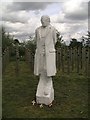
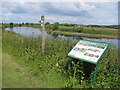
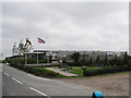
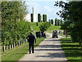
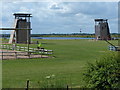
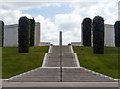
Photos of DE13 7AR

Area Information
Living in DE13 7AR means being part of a compact, residential cluster in England’s countryside. The area spans 43.3 hectares, housing 1,518 people with a population density of 574 per square kilometre. This small postcode is defined by its tight-knit community, where 77% of residents own their homes, and the majority live in houses rather than flats. The median age of 47 suggests a mature demographic, with adults aged 30–64 forming the largest group. Daily life here is likely shaped by proximity to local amenities, with nearby shops and rail links offering practical convenience. While the area lacks major urban infrastructure, its size and density create a sense of familiarity, where neighbours are likely to be known by name. The absence of protected natural areas or planning constraints means development is not restricted, though flood risk remains a critical concern. For those seeking a quiet, self-contained lifestyle, DE13 7AR offers a blend of simplicity and accessibility.
- Area Type
- Postcode
- Area Size
- 43.3 hectares
- Population
- 1518
- Population Density
- 574 people/km²
DE13 7AR is a largely owner-occupied area, with 77% of residents owning their homes. The housing stock is dominated by houses, with no flats or apartments present. This suggests a market focused on family homes rather than rental properties, which may limit availability for buyers seeking short-term accommodation. The small area size—just 43.3 hectares—means the housing stock is limited, potentially increasing competition among buyers. For those considering the area, the high home ownership rate indicates a stable market with long-term residents, which can be a positive sign for property value retention. However, the absence of diverse housing types may restrict options for first-time buyers or those requiring different property configurations. The compact nature of the postcode also means that properties are likely to be spread sparsely, requiring buyers to consider commuting distances to larger towns or cities for additional amenities.
House Prices in DE13 7AR
Showing 3 properties
| Address | Type | Beds | Baths | Last Sale Price | Last Sale Date | |
|---|---|---|---|---|---|---|
| The Scoff Stop, Croxall Road, Alrewas, Burton Upon Trent, DE13 7AR | Restaurant | - | - | - | - | |
| Railway Station, The National Memorial Arboretum, Croxall Road, Alrewas, Burton Upon Trent, DE13 7AR | commercial | - | - | - | - | |
| Croxall Lakes, Croxall Road, Lichfield, DE13 7AR | Leisure | - | - | - | - |
Energy Efficiency in DE13 7AR
Residents of DE13 7AR have access to a small but functional network of amenities. The area includes five retail outlets, notably Co-op stores in Alrewas, Fradley, and Barton-Under, providing basic shopping needs. These locations suggest a focus on convenience for daily essentials rather than large retail chains. For transport, two railway stations offer connections to Lichfield and beyond, though the specific services available are not detailed. The absence of parks, leisure facilities, or dining options in the data means that recreational activities may require travel to nearby towns. The compact nature of the area means that amenities are likely to be concentrated in nearby villages, requiring residents to plan trips for non-essential services. The lifestyle here appears to prioritise practicality over luxury, with a reliance on local shops and rail links to access broader opportunities.
Amenities
Schools
Residents of DE13 7AR have access to two primary schools: All Saints CofE (C) Primary School and All Saints Church of England Primary and Nursery School. Both institutions cater to younger children, providing a range of educational options for families. The presence of two primary schools within practical reach suggests a focus on early education, though no secondary schools are listed in the data. This could mean that students may need to travel to nearby towns for secondary education. The availability of two primary schools may reduce the need for long commutes for younger children, supporting a family-friendly environment. However, the lack of information on Ofsted ratings or academic performance means prospective parents must investigate further to assess the quality of education. For those prioritising proximity to schools, DE13 7AR offers immediate access to primary-level education.
| Rank | School | Type | Entry gender | Ages |
|---|
Explore more schools in this area
Go to Schools tabDemographics
DE13 7AR’s population of 1,518 is spread across 43.3 hectares, resulting in a density of 574 people per square kilometre. The median age of 47 indicates a community skewed towards middle-aged and older residents, with the 30–64 age group forming the largest demographic. Home ownership is high at 77%, reflecting a preference for long-term residency over rental properties. The area is predominantly occupied by houses, with no flats or apartments recorded. The predominant ethnic group is White, though specific diversity metrics are not provided. The population density, while moderate, suggests a balance between private living space and communal interaction. For families, this translates to a stable environment with established networks. However, the lack of detailed deprivation data means it’s unclear how socioeconomic factors influence access to services or quality of life. The age profile implies a community with established careers and possibly retired individuals, contributing to a steady, low-turnover housing market.
Household Size
Accommodation Type
Tenure
Ethnic Group
Religion
Household Composition
Age
Household Deprivation
NS-SEC
Explore more demographic insights in this area
Go to Demographics tabPlanning
Planning Constraints
- Flood RiskPremium
- Ramsar Wetland SitesPremium
- Area of Outstanding Natural BeautyPremium
- Protected Nature ReservePremium
- Protected WoodlandPremium