Area Overview for DE13 0WJ
Photos of DE13 0WJ
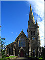
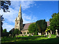
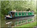
43 photos from this area
Area Information
Key information about the DE13 0WJ including its size, population, and administrative classification.
- Area Type
- Postcode
- Area Size
- 3.5 hectares
- Population
- 1276
- Population Density
- 5238 people/km²
House Prices in DE13 0WJ
37
Properties
£222,723
Average Sold Price
£67,000
Lowest Price
£515,593
Highest Price
Showing 37 properties
| Address | Type | Beds | Baths | Last Sale Price | Last Sale Date | |
|---|---|---|---|---|---|---|
| 10 Knightsbridge Way, Stretton, DE13 0WJ | Detached | 4 | 2 | £310,000 | Dec 2025 | |
| 20 Knightsbridge Way, Stretton, DE13 0WJ | house | - | - | £327,500 | Mar 2024 | |
| 64A Knightsbridge Way, Stretton, DE13 0WJ | Detached | 4 | 2 | £269,000 | Feb 2024 | |
| 56 Knightsbridge Way, Stretton, DE13 0WJ | Detached | 4 | 2 | £305,000 | Feb 2024 | |
| 64 Knightsbridge Way, Stretton, DE13 0WJ | house | - | - | £264,950 | Dec 2021 | |
| 48 Knightsbridge Way, Stretton, DE13 0WJ | Detached | 4 | - | £264,000 | Jun 2021 | |
| 58 Knightsbridge Way, Stretton, DE13 0WJ | house | 5 | - | £515,593 | Nov 2020 | |
| 30 Knightsbridge Way, Stretton, DE13 0WJ | Detached | 4 | 2 | £225,000 | Sep 2018 | |
| 50 Knightsbridge Way, Stretton, DE13 0WJ | Detached | 4 | 1 | £245,500 | Jun 2018 | |
| 42 Knightsbridge Way, Stretton, DE13 0WJ | Detached | 3 | - | £192,000 | Oct 2016 |
Page 1 of 4
Energy Efficiency in DE13 0WJ
Amenities
Schools
| Rank | School | Type | Entry gender | Ages |
|---|
Explore more schools in this area
Go to Schools tabDemographics
Household Size
Two person
most common
Accommodation Type
Houses
most common
Tenure
84
majority
Ethnic Group
White
most common
Religion
N/A
most common
Household Composition
N/A
most common
Age
47
median
Adults (30-64 years)
most common
Household Deprivation
N/A
with no deprivation
NS-SEC
34
in Lower managerial occupations
Explore more demographic insights in this area
Go to Demographics tabPlanning
Planning Constraints
- Flood RiskPremium
- Ramsar Wetland SitesPremium
- Area of Outstanding Natural BeautyPremium
- Protected Nature ReservePremium
- Protected WoodlandPremium