Area Overview for DE13 0SN
Photos of DE13 0SN
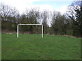
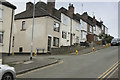
9 photos from this area
Area Information
Key information about the DE13 0SN including its size, population, and administrative classification.
- Area Type
- Postcode
- Area Size
- 9.2 hectares
- Population
- 2309
- Population Density
- 996 people/km²
House Prices in DE13 0SN
35
Properties
£311,625
Average Sold Price
£225,000
Lowest Price
£480,000
Highest Price
Showing 35 properties
| Address | Type | Beds | Baths | Last Sale Price | Last Sale Date | |
|---|---|---|---|---|---|---|
| 27 Maple Drive, Burton Upon Trent, DE13 0SN | house | - | - | £480,000 | Oct 2024 | |
| 23 Maple Drive, Burton Upon Trent, DE13 0SN | Detached | 4 | 4 | £322,500 | Aug 2023 | |
| 22 Maple Drive, Burton Upon Trent, DE13 0SN | Detached | 4 | 2 | £330,000 | Apr 2023 | |
| 29 Maple Drive, Burton Upon Trent, DE13 0SN | house | - | - | £400,000 | Oct 2020 | |
| 31 Maple Drive, Burton Upon Trent, DE13 0SN | Semi-detached | 4 | 3 | £235,000 | Oct 2020 | |
| 33 Maple Drive, Burton Upon Trent, DE13 0SN | house | - | - | £250,000 | Oct 2020 | |
| 25 Maple Drive, Burton Upon Trent, DE13 0SN | house | - | - | £400,000 | Oct 2020 | |
| 35 Maple Drive, Burton Upon Trent, DE13 0SN | house | - | - | £350,000 | Jul 2020 | |
| 45 Maple Drive, Burton Upon Trent, DE13 0SN | house | - | - | £285,000 | Jun 2020 | |
| 8 Maple Drive, Burton Upon Trent, DE13 0SN | house | - | - | £290,000 | Apr 2020 |
Page 1 of 4
Energy Efficiency in DE13 0SN
Amenities
Schools
| Rank | School | Type | Entry gender | Ages |
|---|
Explore more schools in this area
Go to Schools tabDemographics
Household Size
Two person
most common
Accommodation Type
Houses
most common
Tenure
88
majority
Ethnic Group
White
most common
Religion
N/A
most common
Household Composition
N/A
most common
Age
47
median
Adults (30-64 years)
most common
Household Deprivation
N/A
with no deprivation
NS-SEC
41
in Lower managerial occupations
Explore more demographic insights in this area
Go to Demographics tabPlanning
Planning Constraints
- Flood RiskPremium
- Ramsar Wetland SitesPremium
- Area of Outstanding Natural BeautyPremium
- Protected Nature ReservePremium
- Protected WoodlandPremium