Area Overview for DE13 0NY
Photos of DE13 0NY
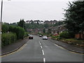
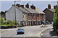

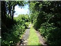
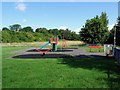
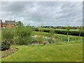
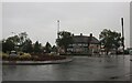
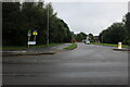
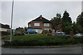
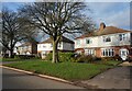
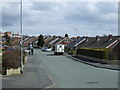
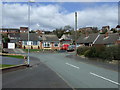
22 photos from this area
Area Information
Key information about the DE13 0NY including its size, population, and administrative classification.
- Area Type
- Postcode
- Area Size
- 2.3 hectares
- Population
- 2309
- Population Density
- 996 people/km²
House Prices in DE13 0NY
33
Properties
£212,952
Average Sold Price
£66,000
Lowest Price
£392,000
Highest Price
Showing 33 properties
| Address | Type | Beds | Baths | Last Sale Price | Last Sale Date | |
|---|---|---|---|---|---|---|
| 234 Tutbury Road, Burton Upon Trent, DE13 0NY | Bungalow | 3 | 2 | £392,000 | Nov 2024 | |
| 240 Tutbury Road, Burton Upon Trent, DE13 0NY | Detached | 3 | 2 | £290,000 | Sep 2023 | |
| 216 Tutbury Road, Burton Upon Trent, DE13 0NY | Semi-detached | 2 | - | £195,000 | Jul 2023 | |
| 274 Tutbury Road, Burton Upon Trent, DE13 0NY | Detached | 3 | 1 | £250,000 | May 2023 | |
| 268 Tutbury Road, Burton Upon Trent, DE13 0NY | Retail | 3 | 1 | £279,950 | Aug 2022 | |
| 212 Tutbury Road, Burton Upon Trent, DE13 0NY | Semi-detached | 3 | 2 | £250,000 | Aug 2022 | |
| 220 Tutbury Road, Burton Upon Trent, DE13 0NY | Detached | 4 | 1 | £300,000 | Oct 2020 | |
| 214 Tutbury Road, Burton Upon Trent, DE13 0NY | house | - | - | £179,000 | Jun 2018 | |
| 272 Tutbury Road, Burton Upon Trent, DE13 0NY | Semi-detached | 3 | 1 | £175,000 | Nov 2017 | |
| 226 Tutbury Road, Burton Upon Trent, DE13 0NY | Detached | 4 | 2 | £285,000 | Jul 2016 |
Page 1 of 4
Energy Efficiency in DE13 0NY
Amenities
Schools
| Rank | School | Type | Entry gender | Ages |
|---|
Explore more schools in this area
Go to Schools tabDemographics
Household Size
Two person
most common
Accommodation Type
Houses
most common
Tenure
88
majority
Ethnic Group
White
most common
Religion
N/A
most common
Household Composition
N/A
most common
Age
47
median
Adults (30-64 years)
most common
Household Deprivation
N/A
with no deprivation
NS-SEC
41
in Lower managerial occupations
Explore more demographic insights in this area
Go to Demographics tabPlanning
Planning Constraints
- Flood RiskPremium
- Ramsar Wetland SitesPremium
- Area of Outstanding Natural BeautyPremium
- Protected Nature ReservePremium
- Protected WoodlandPremium