Area Overview for CW3 9NH
Photos of CW3 9NH

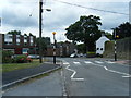
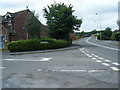
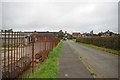


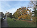

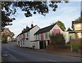

50 photos from this area
Area Information
Key information about the CW3 9NH including its size, population, and administrative classification.
- Area Type
- Postcode
- Area Size
- 1.8 hectares
- Population
- 1043
- Population Density
- 659 people/km²
House Prices in CW3 9NH
50
Properties
£111,406
Average Sold Price
£46,500
Lowest Price
£177,500
Highest Price
Showing 50 properties
| Address | Type | Beds | Baths | Last Sale Price | Last Sale Date | |
|---|---|---|---|---|---|---|
| 26 Morningside, Madeley, Newcastle Under Lyme, CW3 9NH | Semi-detached | 2 | 1 | £143,000 | Jun 2025 | |
| 53 Morningside, Madeley, Newcastle Under Lyme, CW3 9NH | Semi-detached | 2 | 1 | £110,000 | Jun 2023 | |
| 43 Morningside, Madeley, Newcastle Under Lyme, CW3 9NH | Semi-detached | 2 | 1 | £150,000 | Dec 2022 | |
| 56 Morningside, Madeley, Newcastle Under Lyme, CW3 9NH | Retail | 3 | 1 | £177,500 | Nov 2022 | |
| 35 Morningside, Madeley, Newcastle Under Lyme, CW3 9NH | house | - | - | £170,000 | Dec 2021 | |
| 45 Morningside, Madeley, Newcastle Under Lyme, CW3 9NH | Semi-detached | 3 | 1 | £132,500 | Feb 2021 | |
| 57 Morningside, Madeley, Newcastle Under Lyme, CW3 9NH | Terraced | 2 | 1 | £94,000 | Mar 2020 | |
| 54 Morningside, Madeley, Newcastle Under Lyme, CW3 9NH | house | 3 | 1 | £90,000 | Jun 2019 | |
| 39 Morningside, Madeley, Newcastle Under Lyme, CW3 9NH | Terraced | 2 | 1 | £128,000 | Dec 2018 | |
| 41 Morningside, Madeley, Newcastle Under Lyme, CW3 9NH | Semi-detached | 3 | 1 | £98,000 | Feb 2018 |
Page 1 of 5
Energy Efficiency in CW3 9NH
Amenities
Schools
| Rank | School | Type | Entry gender | Ages |
|---|
Explore more schools in this area
Go to Schools tabDemographics
Household Size
Two person
most common
Accommodation Type
Houses
most common
Tenure
56
majority
Ethnic Group
White
most common
Religion
N/A
most common
Household Composition
N/A
most common
Age
47
median
Adults (30-64 years)
most common
Household Deprivation
N/A
with no deprivation
NS-SEC
25
in Lower managerial occupations
Explore more demographic insights in this area
Go to Demographics tabPlanning
Planning Constraints
- Flood RiskPremium
- Ramsar Wetland SitesPremium
- Area of Outstanding Natural BeautyPremium
- Protected Nature ReservePremium
- Protected WoodlandPremium