Area Overview for CW3 9LY
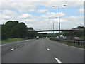
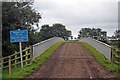
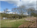
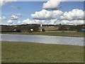
Photos of CW3 9LY


Area Information
CW3 9LY is a small, tightly knit residential area in England, encompassing 44.4 hectares with a population of 1,469 people. Its low density of 92 people per square kilometre suggests a quiet, community-focused environment. Situated near the River Severn and within the Telford new town, the area benefits from proximity to historical sites like Ironbridge and Coalbrookdale. This postcode falls within Madeley, a town with roots in the Domesday Book and a legacy of coal and ironstone mining. Today, it offers a blend of modern living with historical context, making it appealing to those seeking a balance between tradition and convenience. The area’s compact size means amenities and services are within practical reach, while its location near major transport routes, including rail links to Stoke and Longport, supports both local and regional connectivity. With a median age of 47 and a population skewed toward adults aged 30–64, CW3 9LY is a stable, family-oriented community. Its small scale and low crime risk make it an attractive option for buyers prioritising safety and a sense of place.
- Area Type
- Postcode
- Area Size
- 44.4 hectares
- Population
- 1469
- Population Density
- 92 people/km²
CW3 9LY is primarily an owner-occupied area, with 75% of homes owned by their residents rather than rented out. The accommodation type is predominantly houses, which is typical of smaller, rural or semi-rural postcode areas. This suggests a housing stock that is largely family-friendly, with properties designed for long-term occupancy rather than short-term rental. The small size of the area—just 44.4 hectares—means the number of available homes is limited, potentially making the property market competitive for buyers. However, the high home ownership rate indicates that many properties are likely to be long-term investments, reducing turnover. For those seeking a home here, the focus on houses rather than flats may appeal to buyers prioritising space and privacy. Proximity to nearby towns like Ironbridge and Shifnal could also mean that buyers have access to a broader range of property options if the local market becomes saturated.
House Prices in CW3 9LY
No properties found in this postcode.
Energy Efficiency in CW3 9LY
Living in CW3 9LY offers access to a range of nearby amenities that support daily life. The area is served by five retail outlets, including Waitrose and two Co-op stores, providing convenience for grocery shopping and general retail needs. These shops are strategically located to serve the local population, ensuring that essentials are within practical reach. For transport, three railway stations—Longport, Stoke, and others—are nearby, offering connections to regional hubs and facilitating commuting. While the area itself is small, its proximity to larger towns like Ironbridge and Telford means that residents can access additional services, cultural attractions, and leisure opportunities. The blend of local shops and transport options creates a lifestyle that balances self-sufficiency with the flexibility to explore beyond the immediate postcode. This mix is particularly appealing to those who value convenience without sacrificing the charm of a smaller, community-oriented environment.
Amenities
Schools
The primary school closest to CW3 9LY is Sir John Offley CofE (VC) Primary School, which has an Ofsted rating of ‘good’. This school serves the local community, providing education for younger children and offering a solid foundation for families with school-age dependents. The absence of secondary schools in the immediate vicinity means that students may need to commute to nearby towns such as Ironbridge or Telford for further education. However, the ‘good’ rating at the primary level suggests a reliable and well-regarded institution, which is a key consideration for parents. The single primary school in the area reflects the small scale of CW3 9LY, but its quality ensures that local children receive a standard of education that is likely to meet most parents’ expectations. For families prioritising proximity to schools, the presence of a ‘good’-rated primary is a significant advantage.
| Rank | School | Type | Entry gender | Ages |
|---|
Explore more schools in this area
Go to Schools tabDemographics
The population of CW3 9LY is predominantly adults aged 30–64, with a median age of 47. This suggests a mature, settled community with a strong presence of middle-aged residents, many of whom may be raising families or nearing retirement. Home ownership is high at 75%, indicating a stable housing market and long-term residency. The area is characterised by houses rather than flats, reflecting a preference for single-family homes. The predominant ethnic group is White, with no data provided on other demographics. This homogeneity may contribute to a cohesive community feel but could also limit cultural diversity. The low population density of 92 people per square kilometre further reinforces the area’s quiet, suburban character. For those considering life here, the demographic profile suggests a neighbourhood where neighbours are likely to be familiar, and local institutions such as schools and shops play a central role in daily life.
Household Size
Accommodation Type
Tenure
Ethnic Group
Religion
Household Composition
Age
Household Deprivation
NS-SEC
Explore more demographic insights in this area
Go to Demographics tabPlanning
Planning Constraints
- Flood RiskPremium
- Ramsar Wetland SitesPremium
- Area of Outstanding Natural BeautyPremium
- Protected Nature ReservePremium
- Protected WoodlandPremium