Area Overview for CV9 2SQ
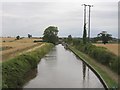
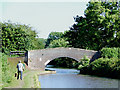
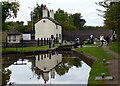
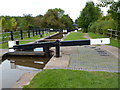
Photos of CV9 2SQ


Area Information
CV9 2SQ is a small, tightly knit residential postcode area in north Warwickshire, encompassing 23.9 hectares and home to 2,238 residents. Its compact size fosters a close-knit community, with a population density of 1,544 people per square kilometre. The area sits on historic routes, including the Roman Watling Street (now the A5), near the ancient settlement of Mancetter. Daily life here is shaped by its heritage and proximity to Atherstone, a market town with a medieval layout and preserved historic features. The median age of 47 suggests a mature population, with 75% of residents owning their homes. This mix of tradition and stability makes CV9 2SQ appealing for those seeking a quieter, established environment without sacrificing access to nearby amenities. The area’s small footprint means it is not sprawling, but its density supports local services and a sense of cohesion. For buyers, it offers a chance to live in a place where history and modern convenience intersect, with a population profile that leans toward families and long-term residents.
- Area Type
- Postcode
- Area Size
- 23.9 hectares
- Population
- 2238
- Population Density
- 1544 people/km²
The property market in CV9 2SQ is predominantly owner-occupied, with 75% of homes owned by their residents. This high rate of home ownership suggests a stable, long-term community with limited rental activity. The accommodation type is primarily houses, which contrasts with areas dominated by flats or apartments. This housing stock indicates a focus on traditional, family-friendly properties, likely with gardens and more space than urban alternatives. Given the area’s small size and compact layout, the housing stock is unlikely to be extensive, meaning buyers should consider proximity to Atherstone or nearby towns for more options. The high home ownership rate also implies that properties here may hold value over time, particularly for those seeking a secure investment. However, the limited scale of the area means the market is niche, with fewer choices compared to larger towns or cities.
House Prices in CV9 2SQ
No properties found in this postcode.
Energy Efficiency in CV9 2SQ
The lifestyle in CV9 2SQ is shaped by its proximity to Atherstone’s historic and commercial centres. Within practical reach are retail options such as Tesco Atherstone, Aldi Atherstone, and Morrisons Daily, offering convenience for daily shopping needs. The area’s small size means residents can access these amenities without long commutes. The presence of multiple rail stations, including Atherstone and Polesworth, adds to the area’s connectivity, enabling easy travel to nearby towns and cities. While the data does not mention parks or leisure facilities, the historic character of Atherstone—such as its preserved medieval layout and landmarks like St Mary’s Chapel—suggests a community with cultural and heritage interests. The blend of retail access, transport links, and historical context creates a balanced lifestyle, though those seeking extensive leisure options may need to venture further afield.
Amenities
Schools
The nearest school to CV9 2SQ is Atherstone Nursery School, which provides early education services. No primary or secondary schools are listed in the data, meaning families with older children may need to look beyond the immediate area for schooling. The presence of a nursery suggests the area is suitable for young families, but those requiring comprehensive education for children of all ages may find the local options limited. This could influence a buyer’s decision, as proximity to a full range of schools is often a priority. Parents may need to consider commuting to Atherstone or nearby towns for primary and secondary education. The absence of additional schools in the data highlights a potential gap in the area’s infrastructure for growing families.
| Rank | School | Type | Entry gender | Ages |
|---|
Explore more schools in this area
Go to Schools tabDemographics
The population of CV9 2SQ is predominantly adults aged 30–64, with a median age of 47. This indicates a community of middle-aged residents, many of whom may be in their peak working years or raising families. Home ownership is high at 75%, reflecting a stable, long-term demographic. The area is characterised by houses rather than flats, suggesting a focus on traditional family homes. The predominant ethnic group is White, which aligns with broader trends in rural England. While no specific deprivation data is provided, the high home ownership rate and moderate population density suggest a relatively affluent and settled community. The absence of significant diversity data means the area’s social fabric is likely homogenous, which can foster a strong sense of local identity but may limit cultural variety. For buyers, this profile implies a neighbourhood with low turnover and a focus on continuity, though it may not appeal to those seeking a more diverse or dynamic demographic.
Household Size
Accommodation Type
Tenure
Ethnic Group
Religion
Household Composition
Age
Household Deprivation
NS-SEC
Explore more demographic insights in this area
Go to Demographics tabPlanning
Planning Constraints
- Flood RiskPremium
- Ramsar Wetland SitesPremium
- Area of Outstanding Natural BeautyPremium
- Protected Nature ReservePremium
- Protected WoodlandPremium