Area Overview for CV9 2JD
Photos of CV9 2JD
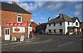
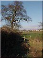
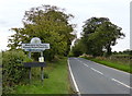
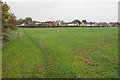
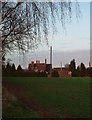
13 photos from this area
Area Information
Key information about the CV9 2JD including its size, population, and administrative classification.
- Area Type
- Postcode
- Area Size
- 1.9 hectares
- Population
- 1420
- Population Density
- 460 people/km²
House Prices in CV9 2JD
33
Properties
£151,114
Average Sold Price
£65,000
Lowest Price
£330,000
Highest Price
Showing 33 properties
| Address | Type | Beds | Baths | Last Sale Price | Last Sale Date | |
|---|---|---|---|---|---|---|
| 37 Knowle Hill, Hurley, CV9 2JD | Terraced | 1 | 1 | £158,186 | Aug 2025 | |
| 17 Knowle Hill, Hurley, CV9 2JD | Terraced | 2 | 1 | £205,300 | Feb 2024 | |
| 15 Knowle Hill, Hurley, CV9 2JD | Terraced | 3 | 1 | £330,000 | Nov 2023 | |
| 4 Knowle Hill, Hurley, CV9 2JD | Cottage | 2 | 1 | £179,950 | Dec 2022 | |
| 55 Knowle Hill, Hurley, CV9 2JD | Semi-detached | 2 | 1 | £160,000 | Nov 2018 | |
| 12 Knowle Hill, Hurley, CV9 2JD | Detached | 3 | 1 | £228,000 | Dec 2017 | |
| 57 Knowle Hill, Hurley, CV9 2JD | Semi-detached | 3 | 1 | £147,000 | Aug 2017 | |
| 19 Knowle Hill, Hurley, CV9 2JD | Terraced | 2 | - | £116,500 | May 2014 | |
| 20 Knowle Hill, Hurley, CV9 2JD | house | 3 | - | £223,500 | Oct 2012 | |
| 8 Knowle Hill, Hurley, CV9 2JD | Cottage | 3 | - | £105,000 | Sep 2011 |
Page 1 of 4
Energy Efficiency in CV9 2JD
Amenities
Schools
| Rank | School | Type | Entry gender | Ages |
|---|
Explore more schools in this area
Go to Schools tabDemographics
Household Size
Family (3-5 people)
most common
Accommodation Type
Houses
most common
Tenure
58
majority
Ethnic Group
White
most common
Religion
N/A
most common
Household Composition
N/A
most common
Age
47
median
Adults (30-64 years)
most common
Household Deprivation
N/A
with no deprivation
NS-SEC
24
in Lower managerial occupations
Explore more demographic insights in this area
Go to Demographics tabPlanning
Planning Constraints
- Flood RiskPremium
- Ramsar Wetland SitesPremium
- Area of Outstanding Natural BeautyPremium
- Protected Nature ReservePremium
- Protected WoodlandPremium