Area Overview for CV9 2JA
Photos of CV9 2JA
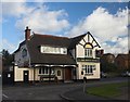
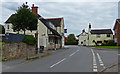
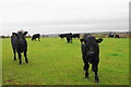
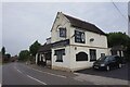
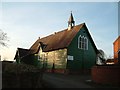
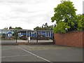
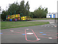
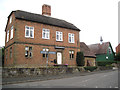
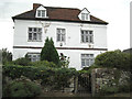
15 photos from this area
Area Information
Key information about the CV9 2JA including its size, population, and administrative classification.
- Area Type
- Postcode
- Area Size
- 7328 m²
- Population
- 1420
- Population Density
- 460 people/km²
House Prices in CV9 2JA
9
Properties
£368,200
Average Sold Price
£170,000
Lowest Price
£900,000
Highest Price
Showing 9 properties
| Address | Type | Beds | Baths | Last Sale Price | Last Sale Date | |
|---|---|---|---|---|---|---|
| 115 Knowle Hill, Hurley, CV9 2JA | Bungalow | 4 | 3 | £900,000 | Jun 2023 | |
| 109 Knowle Hill, Hurley, CV9 2JA | Semi-detached | 2 | - | £170,000 | Jan 2021 | |
| 107 Knowle Hill, Hurley, CV9 2JA | Semi-detached | 2 | 1 | £195,000 | Mar 2019 | |
| 105 Knowle Hill, Hurley, CV9 2JA | Detached | - | - | £216,000 | Jul 2006 | |
| 117 Knowle Hill, Hurley, CV9 2JA | Detached | 3 | 2 | £360,000 | Nov 2005 | |
| 103A Knowle Hill, Hurley, CV9 2JA | Bungalow | 3 | 1 | - | - | |
| 113 Knowle Hill, Hurley, CV9 2JA | Semi-detached | - | - | - | - | |
| 111 Knowle Hill, Hurley, CV9 2JA | Semi-detached | - | - | - | - | |
| Pear Tree Pharmacy, 103 Knowle Hill, Hurley, CV9 2JA | commercial | - | - | - | - |
Energy Efficiency in CV9 2JA
Amenities
Schools
| Rank | School | Type | Entry gender | Ages |
|---|
Explore more schools in this area
Go to Schools tabDemographics
Household Size
Family (3-5 people)
most common
Accommodation Type
Houses
most common
Tenure
58
majority
Ethnic Group
White
most common
Religion
N/A
most common
Household Composition
N/A
most common
Age
47
median
Adults (30-64 years)
most common
Household Deprivation
N/A
with no deprivation
NS-SEC
24
in Lower managerial occupations
Explore more demographic insights in this area
Go to Demographics tabPlanning
Planning Constraints
- Flood RiskPremium
- Ramsar Wetland SitesPremium
- Area of Outstanding Natural BeautyPremium
- Protected Nature ReservePremium
- Protected WoodlandPremium