Area Overview for CV9 2ET
Photos of CV9 2ET
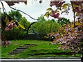
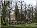
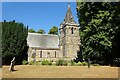
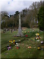

8 photos from this area
Area Information
Key information about the CV9 2ET including its size, population, and administrative classification.
- Area Type
- Postcode
- Area Size
- 1.9 hectares
- Population
- 1550
- Population Density
- 366 people/km²
House Prices in CV9 2ET
48
Properties
£149,683
Average Sold Price
£45,950
Lowest Price
£340,000
Highest Price
Showing 48 properties
| Address | Type | Beds | Baths | Last Sale Price | Last Sale Date | |
|---|---|---|---|---|---|---|
| 12 Little Brum, Grendon, CV9 2ET | Terraced | 2 | 1 | £150,000 | Jun 2025 | |
| 17 Little Brum, Grendon, CV9 2ET | Semi-detached | 2 | 1 | £163,000 | Nov 2023 | |
| 11 Little Brum, Grendon, CV9 2ET | Retail | 2 | 1 | £294,400 | Jun 2022 | |
| 23 Little Brum, Grendon, CV9 2ET | house | 1 | 1 | £123,000 | Apr 2022 | |
| 27 Little Brum, Grendon, CV9 2ET | Terraced | 1 | 1 | £128,000 | Aug 2021 | |
| 4 Little Brum, Grendon, CV9 2ET | house | - | - | £132,000 | Aug 2020 | |
| 34 Little Brum, Grendon, CV9 2ET | Terraced | 3 | 1 | £130,000 | Aug 2019 | |
| 66 Little Brum, Grendon, CV9 2ET | Bungalow | 5 | 3 | £340,000 | Aug 2018 | |
| 48 Little Brum, Grendon, CV9 2ET | Semi-detached | 2 | 1 | £92,500 | Nov 2014 | |
| 25 Little Brum, Grendon, CV9 2ET | Semi-detached | 1 | 1 | £87,500 | Jan 2014 |
Page 1 of 5
Energy Efficiency in CV9 2ET
Amenities
Schools
| Rank | School | Type | Entry gender | Ages |
|---|
Explore more schools in this area
Go to Schools tabDemographics
Household Size
Two person
most common
Accommodation Type
Houses
most common
Tenure
68
majority
Ethnic Group
White
most common
Religion
N/A
most common
Household Composition
N/A
most common
Age
47
median
Adults (30-64 years)
most common
Household Deprivation
N/A
with no deprivation
NS-SEC
22
in Lower managerial occupations
Explore more demographic insights in this area
Go to Demographics tabPlanning
Planning Constraints
- Flood RiskPremium
- Ramsar Wetland SitesPremium
- Area of Outstanding Natural BeautyPremium
- Protected Nature ReservePremium
- Protected WoodlandPremium