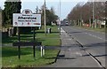
Area Overview for CV9 1NB
Photos of CV9 1NB
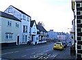
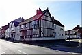
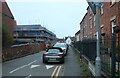
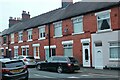
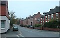
34 photos from this area
Area Information
Key information about the CV9 1NB including its size, population, and administrative classification.
- Area Type
- Postcode
- Area Size
- 2.2 hectares
- Population
- 1218
- Population Density
- 410 people/km²
House Prices in CV9 1NB
14
Properties
£175,494
Average Sold Price
£54,000
Lowest Price
£312,500
Highest Price
Showing 14 properties
| Address | Type | Beds | Baths | Last Sale Price | Last Sale Date | |
|---|---|---|---|---|---|---|
| 12 Ivor Road, Atherstone, CV9 1NB | Semi-detached | 3 | 1 | £275,000 | May 2024 | |
| Mayvilla, 8 Ivor Road, Atherstone, CV9 1NB | house | - | - | £239,950 | Oct 2018 | |
| Clifton, 7 Ivor Road, Atherstone, CV9 1NB | Semi-detached | 3 | 1 | £155,000 | Jul 2016 | |
| Anvil House, 11 Ivor Road, Atherstone, CV9 1NB | Detached | 5 | 3 | £312,500 | Nov 2015 | |
| 2 Ivor Road, Atherstone, CV9 1NB | house | - | - | £160,000 | Nov 2010 | |
| 16 Ivor Road, Atherstone, CV9 1NB | Semi-detached | - | - | £83,000 | Mar 2002 | |
| Lynton, 1 Ivor Road, Atherstone, CV9 1NB | Semi-detached | - | - | £54,000 | Nov 2000 | |
| Bron Avon, 9 Ivor Road, Atherstone, CV9 1NB | Detached | - | - | £230,000 | Aug 2000 | |
| 10 Ivor Road, Atherstone, CV9 1NB | Semi-detached | - | - | £70,000 | Nov 1999 | |
| Courtfield, 3 Ivor Road, Atherstone, CV9 1NB | Semi-detached | 3 | 1 | - | - |
Page 1 of 2
Energy Efficiency in CV9 1NB
Amenities
Schools
| Rank | School | Type | Entry gender | Ages |
|---|
Explore more schools in this area
Go to Schools tabDemographics
Household Size
Two person
most common
Accommodation Type
Houses
most common
Tenure
90
majority
Ethnic Group
White
most common
Religion
N/A
most common
Household Composition
N/A
most common
Age
47
median
Adults (30-64 years)
most common
Household Deprivation
N/A
with no deprivation
NS-SEC
32
in Lower managerial occupations
Explore more demographic insights in this area
Go to Demographics tabPlanning
Planning Constraints
- Flood RiskPremium
- Ramsar Wetland SitesPremium
- Area of Outstanding Natural BeautyPremium
- Protected Nature ReservePremium
- Protected WoodlandPremium