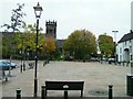
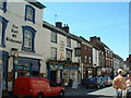
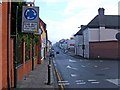
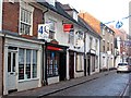
Area Overview for CV9 1HB
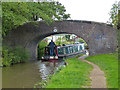
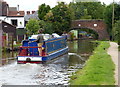
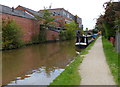
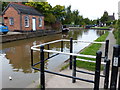
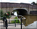
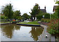
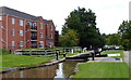
Photos of CV9 1HB

Area Information
CV9 1HB is a small residential postcode area within the historic market town of Atherstone, north Warwickshire. With a population of 1,981, it reflects the character of a closely knit community situated along the A5, a route with Roman origins. The area retains much of its historic layout, shaped by medieval market rights and industrial heritage, including tanning and hatmaking industries that peaked in the 19th century. Daily life here is influenced by its proximity to Atherstone’s railway stations, retail hubs, and cultural landmarks like St Mary’s Chapel, which dates to the 12th century. Residents benefit from practical access to nearby amenities, including supermarkets, rail links, and schools. The postcode sits on the edge of Atherstone’s historic core, blending traditional architecture with modern infrastructure. Its compact size means residents are within walking or cycling distance of shops, parks, and transport nodes, creating a self-contained yet connected living environment. The area’s low flood risk and absence of protected natural sites suggest it is a pragmatic choice for those prioritising safety and accessibility over rural landscapes.
- Area Type
- Postcode
- Area Size
- Not available
- Population
- 1981
- Population Density
- 5863 people/km²
The property market in CV9 1HB is defined by a 26% home ownership rate, suggesting that most properties are rented rather than owned. The accommodation type is predominantly houses, which is typical for smaller towns with limited high-density development. This mix implies a modest housing stock, likely comprising semi-detached or detached homes. For buyers, the area’s small size means competition for available properties is likely to be high, especially given the limited number of new builds. The focus on owner-occupied housing is minimal, so renters may dominate the market. Prospective buyers should consider the area’s compact nature, which may limit options for larger families or those seeking multiple properties. The presence of nearby rail links and retail amenities could enhance the appeal of homes here, though the low home ownership rate suggests a reliance on rental availability.
House Prices in CV9 1HB
Showing 16 properties
| Address | Type | Beds | Baths | Last Sale Price | Last Sale Date | |
|---|---|---|---|---|---|---|
| 16, Angel Yard, Church Street, Atherstone, CV9 1HB | Terraced | 2 | 2 | - | - | |
| 6, Angel Yard, Church Street, Atherstone, CV9 1HB | Terraced | 3 | 2 | - | - | |
| 17, Angel Yard, Church Street, Atherstone, CV9 1HB | Terraced | - | - | - | - | |
| 3, Angel Yard, Church Street, Atherstone, CV9 1HB | Detached | - | - | - | - | |
| 5, Angel Yard, Church Street, Atherstone, CV9 1HB | Terraced | - | - | - | - | |
| 10, Angel Yard, Church Street, Atherstone, CV9 1HB | Terraced | - | - | - | - | |
| 12, Angel Yard, Church Street, Atherstone, CV9 1HB | Terraced | - | - | - | - | |
| 7, Angel Yard, Church Street, Atherstone, CV9 1HB | Terraced | - | - | - | - | |
| 1, Angel Yard, Church Street, Atherstone, CV9 1HB | Detached | - | - | - | - | |
| 15, Angel Yard, Church Street, Atherstone, CV9 1HB | Terraced | - | - | - | - |
Energy Efficiency in CV9 1HB
Living in CV9 1HB offers access to a range of amenities within practical reach. Retail options include Aldi Atherstone, Morrisons Daily, and Co-op Long, providing everyday shopping needs. The area’s rail network connects residents to Atherstone, Polesworth, and Nuneaton stations, enhancing access to broader services. Historic sites like St Mary’s Chapel and the restored 1847 railway station building add cultural value, while the Shrove Tuesday Ball Game, a centuries-old tradition, offers local events. The mix of retail, transport, and heritage sites creates a lifestyle that balances practicality with historical charm. The compact nature of the area means residents can walk or cycle to most amenities, fostering a sense of community. However, the limited number of leisure or recreational facilities may require travel to nearby towns for more extensive options.
Amenities
Schools
Residents of CV9 1HB have access to three notable schools within practical reach. Atherstone Grammar School is a state school offering a broad curriculum, while OneSchool Global UK is an independent institution, likely catering to families seeking alternative educational models. The Independent Educational Services is a special school, providing tailored support for students with specific needs. The mix of school types offers families flexibility, whether prioritising affordability, academic diversity, or specialist provision. However, the absence of data on Ofsted ratings means potential buyers must independently verify the quality of education. The presence of both state and independent options suggests the area can accommodate varied preferences, though the limited number of schools may impact catchment areas and competition for places.
| Rank | School | Type | Entry gender | Ages |
|---|
Explore more schools in this area
Go to Schools tabDemographics
The population of CV9 1HB has a median age of 47, with the most common age range being adults aged 30–64 years. This suggests a community skewed toward middle-aged individuals, likely including professionals and families. Home ownership accounts for 26% of households, indicating a majority of residents rent their homes. The predominant accommodation type is houses, which aligns with the area’s residential character. The predominant ethnic group is White, reflecting broader demographic trends in the region. While specific data on deprivation is not provided, the relatively low home ownership rate may suggest a mix of rental tenants and owner-occupiers, potentially influencing local housing dynamics. The age profile implies a stable, established population, though the absence of younger households may affect school demand and community vibrancy.
Household Size
Accommodation Type
Tenure
Ethnic Group
Religion
Household Composition
Age
Household Deprivation
NS-SEC
Explore more demographic insights in this area
Go to Demographics tabPlanning
Planning Constraints
- Flood RiskPremium
- Ramsar Wetland SitesPremium
- Area of Outstanding Natural BeautyPremium
- Protected Nature ReservePremium
- Protected WoodlandPremium