Area Overview for CV9 1GD
Photos of CV9 1GD


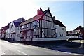
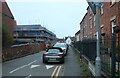
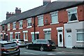
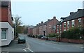
34 photos from this area
Area Information
Key information about the CV9 1GD including its size, population, and administrative classification.
- Area Type
- Postcode
- Area Size
- 4016 m²
- Population
- 1981
- Population Density
- 5863 people/km²
House Prices in CV9 1GD
46
Properties
£155,825
Average Sold Price
£115,000
Lowest Price
£199,950
Highest Price
Showing 46 properties
| Address | Type | Beds | Baths | Last Sale Price | Last Sale Date | |
|---|---|---|---|---|---|---|
| 21, St Clements Court, South Street, Atherstone, CV9 1GD | Flat | 1 | 1 | £130,000 | Aug 2024 | |
| 22, St Clements Court, South Street, Atherstone, CV9 1GD | Flat | 1 | 1 | £120,000 | Jul 2024 | |
| 1, St Clements Court, South Street, Atherstone, CV9 1GD | Flat | 1 | 1 | £127,000 | Dec 2023 | |
| 8, St Clements Court, South Street, Atherstone, CV9 1GD | Flat | - | - | £180,000 | Jul 2023 | |
| 2, St Clements Court, South Street, Atherstone, CV9 1GD | Flat | - | - | £135,000 | Apr 2023 | |
| 32, St Clements Court, South Street, Atherstone, CV9 1GD | Flat | - | - | £160,000 | Nov 2022 | |
| 28, St Clements Court, South Street, Atherstone, CV9 1GD | Flat | 2 | 1 | £195,000 | Apr 2022 | |
| 15, St Clements Court, South Street, Atherstone, CV9 1GD | Flat | - | - | £115,000 | Oct 2021 | |
| 16, St Clements Court, South Street, Atherstone, CV9 1GD | Flat | 2 | 1 | £120,000 | Aug 2021 | |
| 14, St Clements Court, South Street, Atherstone, CV9 1GD | Flat | - | - | £135,000 | Apr 2021 |
Page 1 of 5
Energy Efficiency in CV9 1GD
Amenities
Schools
| Rank | School | Type | Entry gender | Ages |
|---|
Explore more schools in this area
Go to Schools tabDemographics
Household Size
One person
most common
Accommodation Type
Houses
most common
Tenure
26
majority
Ethnic Group
White
most common
Religion
N/A
most common
Household Composition
N/A
most common
Age
47
median
Adults (30-64 years)
most common
Household Deprivation
N/A
with no deprivation
NS-SEC
19
in Lower managerial occupations
Explore more demographic insights in this area
Go to Demographics tabPlanning
Planning Constraints
- Flood RiskPremium
- Ramsar Wetland SitesPremium
- Area of Outstanding Natural BeautyPremium
- Protected Nature ReservePremium
- Protected WoodlandPremium