Area Overview for CV8 3JN
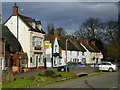
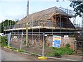
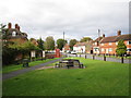
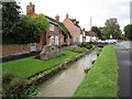
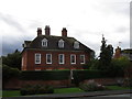
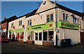
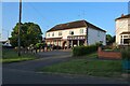
Photos of CV8 3JN
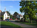
![Main Street cottages [1] in CV8 3JN](https://images.propbar.co.uk/images/geograph/57/76/5776261_120.jpg)
![Main Street cottages [2] in CV8 3JN](https://images.propbar.co.uk/images/geograph/57/76/5776275_120.jpg)
44 photos from this area
Area Information
Key information about the CV8 3JN including its size, population, and administrative classification.
- Area Type
- Postcode
- Area Size
- 9196 m²
- Population
- 1724
- Population Density
- 170 people/km²
House Prices in CV8 3JN
22
Properties
£263,167
Average Sold Price
£157,000
Lowest Price
£435,000
Highest Price
Showing 22 properties
| Address | Type | Beds | Baths | Last Sale Price | Last Sale Date | |
|---|---|---|---|---|---|---|
| 19 Elmdene Close, Wolston, CV8 3JN | Detached | 4 | 1 | £435,000 | May 2023 | |
| 28 Elmdene Close, Wolston, CV8 3JN | Semi-detached | 3 | 1 | £267,500 | Nov 2019 | |
| 20 Elmdene Close, Wolston, CV8 3JN | Detached | 4 | 1 | £395,000 | Jul 2018 | |
| 23 Elmdene Close, Wolston, CV8 3JN | Semi-detached | 3 | - | £195,000 | Dec 2013 | |
| 21 Elmdene Close, Wolston, CV8 3JN | house | - | - | £285,000 | Dec 2013 | |
| 12 Elmdene Close, Wolston, CV8 3JN | house | - | - | £205,000 | Sep 2009 | |
| 32 Elmdene Close, Wolston, CV8 3JN | Semi-detached | - | - | £194,000 | Apr 2007 | |
| 16 Elmdene Close, Wolston, CV8 3JN | house | - | - | £235,000 | Nov 2006 | |
| 8 Elmdene Close, Wolston, CV8 3JN | Detached | - | - | £157,000 | Sep 2001 | |
| 14 Elmdene Close, Wolston, CV8 3JN | Detached | 4 | 2 | - | - |
Page 1 of 3
Energy Efficiency in CV8 3JN
Amenities
Schools
| Rank | School | Type | Entry gender | Ages |
|---|
Explore more schools in this area
Go to Schools tabDemographics
Household Size
Two person
most common
Accommodation Type
Houses
most common
Tenure
83
majority
Ethnic Group
White
most common
Religion
N/A
most common
Household Composition
N/A
most common
Age
47
median
Adults (30-64 years)
most common
Household Deprivation
N/A
with no deprivation
NS-SEC
41
in Lower managerial occupations
Explore more demographic insights in this area
Go to Demographics tabPlanning
Planning Constraints
- Flood RiskPremium
- Ramsar Wetland SitesPremium
- Area of Outstanding Natural BeautyPremium
- Protected Nature ReservePremium
- Protected WoodlandPremium