Area Overview for CV8 3AG
Photos of CV8 3AG
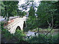
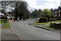
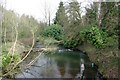
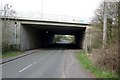
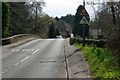
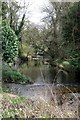
46 photos from this area
Area Information
Key information about the CV8 3AG including its size, population, and administrative classification.
- Area Type
- Postcode
- Area Size
- 27.7 hectares
- Population
- 4079
- Population Density
- 130 people/km²
House Prices in CV8 3AG
40
Properties
£291,863
Average Sold Price
£94,950
Lowest Price
£520,000
Highest Price
Showing 40 properties
| Address | Type | Beds | Baths | Last Sale Price | Last Sale Date | |
|---|---|---|---|---|---|---|
| 16 Mill Hill, Baginton, CV8 3AG | Detached | 3 | 1 | £520,000 | Mar 2025 | |
| 72 Mill Hill, Baginton, CV8 3AG | Semi-detached | 3 | 1 | £475,000 | Jul 2024 | |
| 10 Mill Hill, Baginton, CV8 3AG | Semi-detached | 4 | 2 | £430,000 | May 2024 | |
| 44 Mill Hill, Baginton, CV8 3AG | Semi-detached | 4 | 2 | £435,000 | Feb 2024 | |
| 20 Mill Hill, Baginton, CV8 3AG | house | - | - | £450,000 | Nov 2022 | |
| 12 Mill Hill, Baginton, CV8 3AG | Semi-detached | 3 | 1 | £400,000 | Nov 2021 | |
| 30 Mill Hill, Baginton, CV8 3AG | house | - | - | £396,000 | Apr 2021 | |
| 66 Mill Hill, Baginton, CV8 3AG | Semi-detached | 3 | 1 | £340,000 | Mar 2019 | |
| 40 Mill Hill, Baginton, CV8 3AG | house | - | - | £250,500 | Sep 2017 | |
| 74 Mill Hill, Baginton, CV8 3AG | Semi-detached | 3 | 1 | £334,000 | May 2017 |
Page 1 of 4
Energy Efficiency in CV8 3AG
Amenities
Schools
| Rank | School | Type | Entry gender | Ages |
|---|
Explore more schools in this area
Go to Schools tabDemographics
Household Size
Two person
most common
Accommodation Type
Houses
most common
Tenure
80
majority
Ethnic Group
White
most common
Religion
N/A
most common
Household Composition
N/A
most common
Age
22
median
Young Adults (15-29 years)
most common
Household Deprivation
N/A
with no deprivation
NS-SEC
19
in Lower managerial occupations
Explore more demographic insights in this area
Go to Demographics tabPlanning
Planning Constraints
- Flood RiskPremium
- Ramsar Wetland SitesPremium
- Area of Outstanding Natural BeautyPremium
- Protected Nature ReservePremium
- Protected WoodlandPremium