Area Overview for CV8 3AD
Photos of CV8 3AD
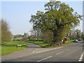
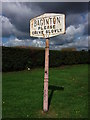

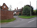
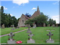
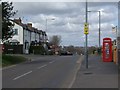
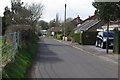
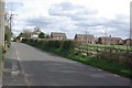
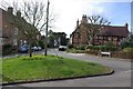
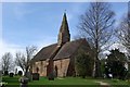
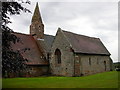
57 photos from this area
Area Information
Key information about the CV8 3AD including its size, population, and administrative classification.
- Area Type
- Postcode
- Area Size
- 7.3 hectares
- Population
- 4079
- Population Density
- 130 people/km²
House Prices in CV8 3AD
21
Properties
£395,346
Average Sold Price
£110,000
Lowest Price
£1,600,000
Highest Price
Showing 21 properties
| Address | Type | Beds | Baths | Last Sale Price | Last Sale Date | |
|---|---|---|---|---|---|---|
| 13 Coventry Road, Baginton, CV8 3AD | Bungalow | 2 | 1 | £285,000 | Feb 2025 | |
| Rosswood Farm Bungalow, Coventry Road, Baginton, CV8 3AD | Detached | - | - | £1,600,000 | Aug 2024 | |
| 9 Coventry Road, Baginton, CV8 3AD | house | - | - | £365,000 | Oct 2023 | |
| Epsilon, 7 Coventry Road, Baginton, CV8 3AD | Detached | 4 | 2 | £625,000 | Oct 2023 | |
| 18 Coventry Road, Baginton, CV8 3AD | Retail | 3 | 2 | £375,000 | Jun 2022 | |
| Delta, 6 Coventry Road, Baginton, CV8 3AD | Bungalow | - | - | £350,000 | Jun 2021 | |
| 12 Coventry Road, Baginton, CV8 3AD | Semi-detached | 2 | 1 | £345,000 | Dec 2020 | |
| 17 Coventry Road, Baginton, CV8 3AD | Bungalow | 3 | 1 | £195,000 | Aug 2020 | |
| 16 Coventry Road, Baginton, CV8 3AD | Bungalow | 2 | 1 | £242,500 | Apr 2017 | |
| 11 Coventry Road, Baginton, CV8 3AD | Semi-detached | 3 | - | £278,000 | Jan 2013 |
Page 1 of 3
Energy Efficiency in CV8 3AD
Amenities
Schools
| Rank | School | Type | Entry gender | Ages |
|---|
Explore more schools in this area
Go to Schools tabDemographics
Household Size
Two person
most common
Accommodation Type
Houses
most common
Tenure
80
majority
Ethnic Group
White
most common
Religion
N/A
most common
Household Composition
N/A
most common
Age
22
median
Young Adults (15-29 years)
most common
Household Deprivation
N/A
with no deprivation
NS-SEC
19
in Lower managerial occupations
Explore more demographic insights in this area
Go to Demographics tabPlanning
Planning Constraints
- Flood RiskPremium
- Ramsar Wetland SitesPremium
- Area of Outstanding Natural BeautyPremium
- Protected Nature ReservePremium
- Protected WoodlandPremium