Area Overview for CV8 2QW
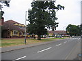
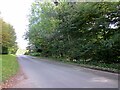
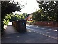
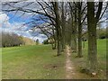
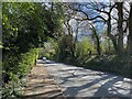
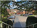
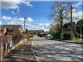
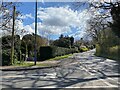
Photos of CV8 2QW

Area Information
CV8 2QW is a small residential postcode area in Warwickshire, England, encompassing a cluster of homes near the historic market town of Kenilworth. With a population of 1516, it reflects a tight-knit community positioned 5.5 miles southwest of Coventry and 4.5 miles north of Warwick. The area’s character is shaped by its proximity to Kenilworth Castle, a Norman keep and Elizabethan garden that once hosted Queen Elizabeth I, and the ruins of Kenilworth Abbey, a 12th-century priory. Daily life here blends modern convenience with historical heritage, offering residents access to nearby towns and amenities while retaining a distinct local identity. The postcode’s compact size means it is ideal for those seeking a quiet, low-density living environment close to cultural and historical landmarks. With a median age of 47 and a strong home ownership rate, the area appeals to families and long-term residents who value stability and community.
- Area Type
- Postcode
- Area Size
- Not available
- Population
- 1516
- Population Density
- 3844 people/km²
The property market in CV8 2QW is characterised by a high home ownership rate of 81%, indicating that most properties are owner-occupied rather than rented out. The accommodation type is predominantly houses, which aligns with the area’s small, residential nature and suburban feel. Given the postcode’s limited size, the housing stock is likely to be relatively uniform, with fewer high-rise or commercial properties. For buyers, this suggests a market where properties are typically family homes rather than investment opportunities. The proximity to Kenilworth and its amenities may enhance property value, but the small area means buyers should consider nearby towns for broader options. The focus on owner-occupation also implies a stable market with long-term residents rather than transient renters.
House Prices in CV8 2QW
No properties found in this postcode.
Energy Efficiency in CV8 2QW
Living in CV8 2QW offers access to a range of practical amenities within easy reach. The area is close to five retail outlets, including Tesco Kenilworth, Waitrose Kenilworth, and Sainsburys Kenilworth, ensuring convenient shopping for daily needs. Three rail stations—Kenilworth, Canley, and Tile Hill—provide efficient links to Coventry, Birmingham, and surrounding areas, supporting both local and regional travel. While no specific parks or leisure facilities are listed, the proximity to Kenilworth’s historic sites, such as the castle and abbey, adds cultural and recreational value. The presence of multiple rail stations and retail hubs enhances the area’s convenience, making it suitable for those prioritising accessibility and practicality in their daily lives.
Amenities
Schools
The nearest school to CV8 2QW is Park Hill Junior School, a primary school with an Ofsted rating of ‘good’. This provides families with access to a well-regarded primary education within the area. However, the data does not list any secondary schools, suggesting that residents may need to look further afield for secondary education. The presence of a primary school with a positive rating is a key advantage for families with young children, offering convenience and a foundation for local schooling. The absence of secondary schools in the immediate vicinity should be considered when evaluating the area’s suitability for growing families.
| Rank | School | Type | Entry gender | Ages |
|---|
Explore more schools in this area
Go to Schools tabDemographics
The population of CV8 2QW has a median age of 47, with the most common age range being adults aged 30–64. This suggests a mature, established community with a focus on family life and long-term residency. Home ownership is high at 81%, indicating a predominantly owner-occupied area with a strong sense of local attachment. The accommodation type is largely houses, reflecting a suburban or semi-rural character rather than high-density housing. The predominant ethnic group is White, though no specific data on diversity or deprivation is provided. The age profile and home ownership rate suggest a stable, low-turnover neighbourhood where residents are likely to have built careers and raised families. The absence of specific data on deprivation or diversity means the area’s social dynamics remain largely defined by its demographic consistency.
Household Size
Accommodation Type
Tenure
Ethnic Group
Religion
Household Composition
Age
Household Deprivation
NS-SEC
Explore more demographic insights in this area
Go to Demographics tabPlanning
Planning Constraints
- Flood RiskPremium
- Ramsar Wetland SitesPremium
- Area of Outstanding Natural BeautyPremium
- Protected Nature ReservePremium
- Protected WoodlandPremium