Area Overview for CV8 2LQ
Photos of CV8 2LQ
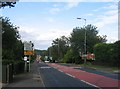
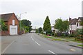

83 photos from this area
Area Information
Key information about the CV8 2LQ including its size, population, and administrative classification.
- Area Type
- Postcode
- Area Size
- 2.4 hectares
- Population
- 1878
- Population Density
- 888 people/km²
House Prices in CV8 2LQ
42
Properties
£865,937
Average Sold Price
£140,000
Lowest Price
£3,085,999
Highest Price
Showing 42 properties
| Address | Type | Beds | Baths | Last Sale Price | Last Sale Date | |
|---|---|---|---|---|---|---|
| 61 Harris Way, Kenilworth, CV8 2LQ | Terraced | 3 | 1 | £140,000 | Jun 2023 | |
| 35 Harris Way, Kenilworth, CV8 2LQ | house | - | - | £316,500 | Mar 2022 | |
| 1 Harris Way, Kenilworth, CV8 2LQ | house | - | - | £880,000 | Dec 2021 | |
| 65 Harris Way, Kenilworth, CV8 2LQ | house | - | - | £800,000 | Feb 2021 | |
| 63 Harris Way, Kenilworth, CV8 2LQ | house | - | - | £610,000 | Oct 2020 | |
| 31 Harris Way, Kenilworth, CV8 2LQ | house | 5 | 3 | £790,000 | Sep 2020 | |
| 33 Harris Way, Kenilworth, CV8 2LQ | house | - | - | £305,000 | Mar 2020 | |
| 49 Harris Way, Kenilworth, CV8 2LQ | Retail | 2 | 1 | £3,085,999 | Nov 2017 | |
| 51 Harris Way, Kenilworth, CV8 2LQ | Terraced | 2 | 1 | - | - | |
| 29 Harris Way, Kenilworth, CV8 2LQ | Detached | 6 | 4 | - | - |
Page 1 of 5
Energy Efficiency in CV8 2LQ
Amenities
Schools
| Rank | School | Type | Entry gender | Ages |
|---|
Explore more schools in this area
Go to Schools tabDemographics
Household Size
Family (3-5 people)
most common
Accommodation Type
Houses
most common
Tenure
86
majority
Ethnic Group
White
most common
Religion
N/A
most common
Household Composition
N/A
most common
Age
47
median
Adults (30-64 years)
most common
Household Deprivation
N/A
with no deprivation
NS-SEC
55
in Lower managerial occupations
Explore more demographic insights in this area
Go to Demographics tabPlanning
Planning Constraints
- Flood RiskPremium
- Ramsar Wetland SitesPremium
- Area of Outstanding Natural BeautyPremium
- Protected Nature ReservePremium
- Protected WoodlandPremium