Area Overview for CV8 2DL
Photos of CV8 2DL
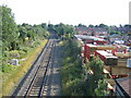
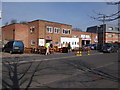
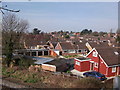
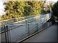
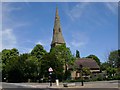
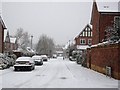
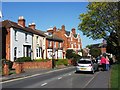
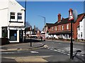

100 photos from this area
Area Information
Key information about the CV8 2DL including its size, population, and administrative classification.
- Area Type
- Postcode
- Area Size
- 7697 m²
- Population
- 1481
- Population Density
- 1900 people/km²
House Prices in CV8 2DL
17
Properties
£307,250
Average Sold Price
£76,500
Lowest Price
£467,500
Highest Price
Showing 17 properties
| Address | Type | Beds | Baths | Last Sale Price | Last Sale Date | |
|---|---|---|---|---|---|---|
| 46 Farmer Ward Road, Kenilworth, CV8 2DL | Bungalow | - | - | £374,500 | Mar 2025 | |
| 40 Farmer Ward Road, Kenilworth, CV8 2DL | Bungalow | 2 | 1 | £400,000 | Jan 2024 | |
| 32 Farmer Ward Road, Kenilworth, CV8 2DL | Semi-detached | 4 | 2 | £395,000 | Feb 2023 | |
| 34 Farmer Ward Road, Kenilworth, CV8 2DL | Semi-detached | 3 | 1 | £467,500 | Nov 2022 | |
| 36 Farmer Ward Road, Kenilworth, CV8 2DL | Semi-detached | 4 | 2 | £415,000 | Dec 2021 | |
| 48 Farmer Ward Road, Kenilworth, CV8 2DL | Bungalow | 2 | 1 | £345,000 | May 2017 | |
| 30 Farmer Ward Road, Kenilworth, CV8 2DL | Semi-detached | 4 | - | £385,000 | Nov 2015 | |
| 20 Farmer Ward Road, Kenilworth, CV8 2DL | Detached | - | - | £415,000 | Aug 2015 | |
| 24 Farmer Ward Road, Kenilworth, CV8 2DL | house | - | - | £284,000 | Mar 2013 | |
| 18 Farmer Ward Road, Kenilworth, CV8 2DL | Bungalow | - | - | £275,000 | Jun 2011 |
Page 1 of 2
Energy Efficiency in CV8 2DL
Amenities
Schools
| Rank | School | Type | Entry gender | Ages |
|---|
Explore more schools in this area
Go to Schools tabDemographics
Household Size
Two person
most common
Accommodation Type
Houses
most common
Tenure
96
majority
Ethnic Group
White
most common
Religion
N/A
most common
Household Composition
N/A
most common
Age
47
median
Elderly (65+ years)
most common
Household Deprivation
N/A
with no deprivation
NS-SEC
56
in Lower managerial occupations
Explore more demographic insights in this area
Go to Demographics tabPlanning
Planning Constraints
- Flood RiskPremium
- Ramsar Wetland SitesPremium
- Area of Outstanding Natural BeautyPremium
- Protected Nature ReservePremium
- Protected WoodlandPremium