Area Overview for CV8 2DA
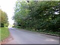
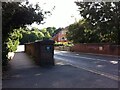
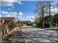
Photos of CV8 2DA


Area Information
CV8 2DA is a compact residential postcode in Warwickshire, England, covering 2.7 hectares and home to 1,637 people. Its high population density of 61,057 people per square kilometre reflects a tightly knit community. Nestled in the market town of Kenilworth, this area is defined by its historic roots, with landmarks like Kenilworth Castle and Abbey ruins shaping its character. The town’s medieval past as a royal stronghold and Tudor entertainment hub contrasts with its modern infrastructure, including five retail outlets and multiple railway stations. Daily life here balances historical charm with practicality, offering residents access to essential services within walking or cycling distance. The area’s compact size means a strong sense of local identity, with community ties reinforced by shared amenities and proximity to cultural heritage sites. For buyers, CV8 2DA presents a unique blend of historic appeal and contemporary convenience, ideal for those seeking a quiet yet connected lifestyle.
- Area Type
- Postcode
- Area Size
- 2.7 hectares
- Population
- 1637
- Population Density
- 3570 people/km²
The property market in CV8 2DA is dominated by owner-occupied homes, with 82% of residents living in properties they own. This high ownership rate indicates a stable market with limited rental activity, suggesting that properties here are more likely to be family homes rather than investment assets. The accommodation type is exclusively houses, not flats or apartments, which is typical of smaller towns with lower population density. This housing stock appeals to buyers seeking traditional, spacious homes with gardens, often in established neighbourhoods. The compact size of the postcode means the market is tightly focused, with limited scope for new developments. Buyers should consider that property values may be influenced by the area’s historical significance and proximity to amenities, though the small size of the area means competition for available listings could be fierce.
House Prices in CV8 2DA
Showing 1 properties
| Address | Type | Beds | Baths | Last Sale Price | Last Sale Date | |
|---|---|---|---|---|---|---|
| Lower School Bungalow, Kenilworth School, Leyes Lane, Kenilworth, CV8 2DA | Detached | - | - | - | - |
Energy Efficiency in CV8 2DA
Living in CV8 2DA offers a mix of practical amenities and historical charm. The area’s retail landscape includes major supermarkets such as Tesco, Waitrose, and Sainsburys in Kenilworth, ensuring easy access to groceries and daily essentials. For dining, the town’s traditional character blends with modern convenience, though specific restaurants are not detailed in the data. The presence of multiple railway stations enhances connectivity, allowing residents to explore nearby towns or cities for leisure. While parks and green spaces are not explicitly listed, the area’s proximity to Kenilworth Castle and Abbey ruins suggests opportunities for walking or historical exploration. The compact size of the postcode means amenities are closely clustered, reducing the need for long commutes. This combination of retail, transport, and cultural heritage creates a lifestyle that balances practicality with a touch of history.
Amenities
Schools
Residents of CV8 2DA have access to a range of educational institutions, including Kenilworth School and Sixth Form, which operates as both a primary school and an academy with an outstanding Ofsted rating. This dual role ensures a seamless transition for students from early education through to secondary schooling. The area also includes Millbrook Grange Day Provision School, a special needs institution providing tailored support for students with specific requirements. The combination of mainstream and specialist schools offers families flexibility, whether they seek a traditional curriculum or specialised educational support. The presence of an outstanding-rated academy underscores the area’s commitment to quality education, making it an attractive option for families prioritising academic standards. Parents should note that the limited number of schools reflects the small size of the postcode, but the diversity of options ensures coverage for different educational needs.
| Rank | School | Type | Entry gender | Ages |
|---|
Explore more schools in this area
Go to Schools tabDemographics
The population of CV8 2DA has a median age of 47, with the majority of residents falling within the 30-64 age range. This suggests a mature, stable community with a focus on long-term residency. Home ownership is high at 82%, indicating a predominance of owner-occupied properties rather than rentals. The area is characterised by houses, not flats, reflecting a suburban or semi-rural housing stock. The predominant ethnic group is White, aligning with broader demographic trends in the region. The absence of specific data on deprivation or diversity means the area’s social dynamics are shaped by a homogenous, middle-aged population. This profile suggests a community prioritising stability, with limited turnover and a focus on established family homes. For buyers, this demographic structure implies a low-risk environment for property investment, with demand likely driven by local needs rather than transient populations.
Household Size
Accommodation Type
Tenure
Ethnic Group
Religion
Household Composition
Age
Household Deprivation
NS-SEC
Explore more demographic insights in this area
Go to Demographics tabPlanning
Planning Constraints
- Flood RiskPremium
- Ramsar Wetland SitesPremium
- Area of Outstanding Natural BeautyPremium
- Protected Nature ReservePremium
- Protected WoodlandPremium