Area Overview for CV8 2BP
Photos of CV8 2BP
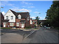

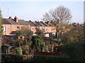
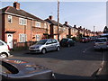
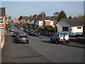
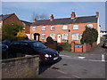
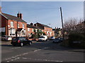
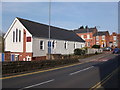
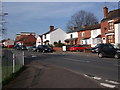
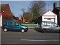
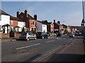
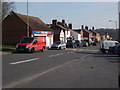
100 photos from this area
Area Information
Key information about the CV8 2BP including its size, population, and administrative classification.
- Area Type
- Postcode
- Area Size
- 4775 m²
- Population
- 1398
- Population Density
- 3681 people/km²
House Prices in CV8 2BP
16
Properties
£202,295
Average Sold Price
£62,000
Lowest Price
£340,000
Highest Price
Showing 16 properties
| Address | Type | Beds | Baths | Last Sale Price | Last Sale Date | |
|---|---|---|---|---|---|---|
| 50 Whitemoor Road, Kenilworth, CV8 2BP | Detached | 5 | 4 | £260,000 | Mar 2025 | |
| 78 Whitemoor Road, Kenilworth, CV8 2BP | Semi-detached | 2 | 1 | £290,000 | Mar 2025 | |
| 70A Whitemoor Road, Kenilworth, CV8 2BP | Flat | - | - | £340,000 | Oct 2022 | |
| 80 Whitemoor Road, Kenilworth, CV8 2BP | Semi-detached | 2 | 1 | £250,000 | Aug 2021 | |
| 62 Whitemoor Road, Kenilworth, CV8 2BP | Terraced | 3 | 2 | £265,000 | May 2014 | |
| 60 Whitemoor Road, Kenilworth, CV8 2BP | house | - | - | £214,000 | Jun 2013 | |
| 58 Whitemoor Road, Kenilworth, CV8 2BP | Terraced | - | - | £80,000 | Jun 2012 | |
| 56 Whitemoor Road, Kenilworth, CV8 2BP | Terraced | - | - | £124,950 | Oct 2002 | |
| 82 Whitemoor Road, Kenilworth, CV8 2BP | Detached | - | - | £137,000 | Feb 2000 | |
| 52 Whitemoor Road, Kenilworth, CV8 2BP | Terraced | - | - | £62,000 | Oct 1996 |
Page 1 of 2
Energy Efficiency in CV8 2BP
Amenities
Schools
| Rank | School | Type | Entry gender | Ages |
|---|
Explore more schools in this area
Go to Schools tabDemographics
Household Size
Two person
most common
Accommodation Type
Houses
most common
Tenure
87
majority
Ethnic Group
White
most common
Religion
N/A
most common
Household Composition
N/A
most common
Age
47
median
Adults (30-64 years)
most common
Household Deprivation
N/A
with no deprivation
NS-SEC
53
in Lower managerial occupations
Explore more demographic insights in this area
Go to Demographics tabPlanning
Planning Constraints
- Flood RiskPremium
- Ramsar Wetland SitesPremium
- Area of Outstanding Natural BeautyPremium
- Protected Nature ReservePremium
- Protected WoodlandPremium