Area Overview for CV8 2AG
Photos of CV8 2AG
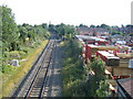
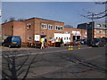
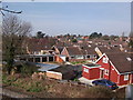
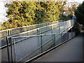
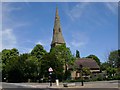
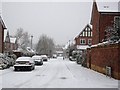
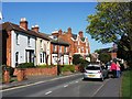
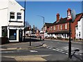
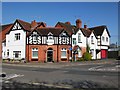
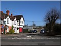

100 photos from this area
Area Information
Key information about the CV8 2AG including its size, population, and administrative classification.
- Area Type
- Postcode
- Area Size
- 1.8 hectares
- Population
- 1481
- Population Density
- 1900 people/km²
House Prices in CV8 2AG
24
Properties
£480,125
Average Sold Price
£122,000
Lowest Price
£850,000
Highest Price
Showing 24 properties
| Address | Type | Beds | Baths | Last Sale Price | Last Sale Date | |
|---|---|---|---|---|---|---|
| 74 Birches Lane, Kenilworth, CV8 2AG | Detached | 4 | 2 | £850,000 | Oct 2024 | |
| 86 Birches Lane, Kenilworth, CV8 2AG | house | - | - | £630,000 | May 2019 | |
| 51 Birches Lane, Kenilworth, CV8 2AG | Semi-detached | 5 | 2 | £478,000 | Mar 2018 | |
| 57 Birches Lane, Kenilworth, CV8 2AG | Detached | 4 | 1 | £615,000 | Jul 2017 | |
| 68 Birches Lane, Kenilworth, CV8 2AG | house | - | - | £653,500 | Apr 2017 | |
| 53 Birches Lane, Kenilworth, CV8 2AG | Detached | 3 | 1 | £380,000 | Mar 2015 | |
| 84 Birches Lane, Kenilworth, CV8 2AG | house | 5 | - | £455,000 | Jan 2013 | |
| 78 Birches Lane, Kenilworth, CV8 2AG | house | - | - | £645,000 | Jun 2007 | |
| 82 Birches Lane, Kenilworth, CV8 2AG | Detached | - | - | £440,000 | Jan 2006 | |
| 47 Birches Lane, Kenilworth, CV8 2AG | Detached | - | - | £370,000 | Feb 2003 |
Page 1 of 3
Energy Efficiency in CV8 2AG
Amenities
Schools
| Rank | School | Type | Entry gender | Ages |
|---|
Explore more schools in this area
Go to Schools tabDemographics
Household Size
Two person
most common
Accommodation Type
Houses
most common
Tenure
96
majority
Ethnic Group
White
most common
Religion
N/A
most common
Household Composition
N/A
most common
Age
47
median
Elderly (65+ years)
most common
Household Deprivation
N/A
with no deprivation
NS-SEC
56
in Lower managerial occupations
Explore more demographic insights in this area
Go to Demographics tabPlanning
Planning Constraints
- Flood RiskPremium
- Ramsar Wetland SitesPremium
- Area of Outstanding Natural BeautyPremium
- Protected Nature ReservePremium
- Protected WoodlandPremium