Area Overview for CV8 1XY
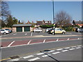
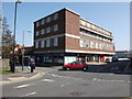
Photos of CV8 1XY


Area Information
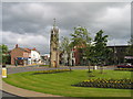
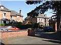
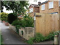
CV8 1XY is a small residential postcode area in Warwickshire, England, nestled within the historic market town of Kenilworth. With a population of 1,691, it reflects the quiet, compact nature of a traditional English village. The area is defined by its medieval heritage, including the ruins of Kenilworth Castle and Abbey, which date back to the 12th century. These landmarks offer a tangible link to the past, with the castle’s Norman keep and extensive moat defences still standing. Daily life here is shaped by a mix of historic charm and modern convenience. Residents benefit from proximity to Kenilworth Railway Station, which connects to Coventry and Warwick within minutes, and a range of retail options, including major supermarkets like Sainsburys and Waitrose. The area’s median age of 47 suggests a mature, stable community, with a strong emphasis on home ownership—61% of residents live in their own homes. This blend of history, accessibility, and a cohesive demographic makes CV8 1XY a distinctive choice for those seeking a settled lifestyle near cultural and natural landmarks.
- Area Type
- Postcode
- Area Size
- Not available
- Population
- 1691
- Population Density
- 4570 people/km²
The property market in CV8 1XY is characterised by a high rate of home ownership—61% of residents live in their own homes—suggesting a stable and established community. The area is primarily composed of houses, which are likely to be family homes given the median age of 47 and the prevalence of adults in the 30–64 age range. This contrasts with areas dominated by rental properties or flats, where turnover is typically higher. The small size of the postcode area means that the housing stock is limited, and buyers should consider the proximity to nearby towns like Coventry and Warwick for broader options. The presence of historic landmarks like Kenilworth Castle may also influence property values, with homes offering views or access to these sites potentially commanding premium prices. For buyers, this small area offers a chance to invest in a well-maintained, owner-occupied market with a distinct character.
House Prices in CV8 1XY
No properties found in this postcode.
Energy Efficiency in CV8 1XY
Living in CV8 1XY provides access to a range of amenities within practical reach. The area includes five retail outlets, such as Iceland Kenilworth, Waitrose Kenilworth, and Sainsburys Kenilworth, ensuring convenience for grocery shopping and daily essentials. The nearby railway stations—Kenilworth, Tile Hill, and Warwick—offer easy access to larger towns and cities, while the proximity to Coventry Airport (listed twice) adds to regional travel options. Historically, the area is defined by landmarks like Kenilworth Castle and Abbey, which contribute to its cultural appeal. The town’s market heritage and quiet village atmosphere combine with modern facilities to create a lifestyle that balances tradition with practicality. Residents can enjoy the convenience of local shops, the ease of rail travel, and the rich historical backdrop, making it suitable for those who value both heritage and accessibility.
Amenities
Schools
The only school explicitly listed near CV8 1XY is the Kenilworth Nursery School & Early Years Training Centre, which provides early education and childcare services. No primary or secondary schools are mentioned in the data, which may require families to look beyond the immediate area for comprehensive schooling. This absence of higher-level educational institutions could be a consideration for parents seeking a full range of school options for their children. However, the proximity to Kenilworth itself—home to historic sites and a market town—may offer alternative learning opportunities or extracurricular activities. For those prioritising a nursery, the local centre is a convenient option, though families with older children may need to explore nearby towns like Coventry or Warwick, which are within short travel distances by rail.
| Rank | School | Type | Entry gender | Ages |
|---|
Explore more schools in this area
Go to Schools tabDemographics
The community in CV8 1XY is predominantly composed of adults aged 30–64, with a median age of 47. This suggests a mature population, likely with established careers and family structures. Home ownership is high at 61%, indicating a strong presence of long-term residents and a stable housing market. The area is primarily residential, with houses as the dominant accommodation type. The predominant ethnic group is White, reflecting the broader demographic patterns of rural Warwickshire. While no specific data on deprivation is provided, the high home ownership rate and low flood risk (score 0) imply a relatively secure and stable environment. However, the crime risk is medium (score 62), which aligns with average rates for the region. This suggests that while the area is generally safe, residents should take standard precautions, such as securing homes and being aware of local conditions.
Household Size
Accommodation Type
Tenure
Ethnic Group
Religion
Household Composition
Age
Household Deprivation
NS-SEC
Explore more demographic insights in this area
Go to Demographics tabPlanning
Planning Constraints
- Flood RiskPremium
- Ramsar Wetland SitesPremium
- Area of Outstanding Natural BeautyPremium
- Protected Nature ReservePremium
- Protected WoodlandPremium