Area Overview for CV8 1RB
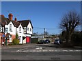
Photos of CV8 1RB


Area Information
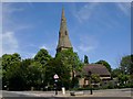
Living in CV8 1RB offers a specific residential experience within the historic market town of Kenilworth. This postcode covers a small cluster comprising 1,277 square metres and serves a population of 1,491 people. The location sits five and a half miles southwest of Coventry and four and a half miles north of Warwick, placing you close to significant historic landmarks. Kenilworth is defined by its castle and abbey ruins, which served as a key medieval stronghold and a venue for Queen Elizabeth I. The area sees residents navigating a landscape shaped by history, including the Norman keep from the 1120s and the Elizabethan garden. Your daily life involves proximity to these cultural sites while accessing modern convenience found in nearby towns. The immediate surroundings reflect a settled community with a strong connection to the past. You are situated in a defined civil parish that balances historical significance with practical living arrangements. The small footprint of the postcode indicates a tight-knit environment where local landmarks play a prominent role in the neighbourhood character.
- Area Type
- Postcode
- Area Size
- 1277 m²
- Population
- 1491
- Population Density
- 4712 people/km²
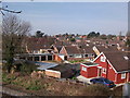
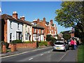
Homes in CV8 1RB represent a market heavily weighted toward ownership and traditional housing styles. With 63% of the population owning their homes, this postcode functions far more as an owner-occupied area than a rental hub. The accommodation type is exclusively listed as houses, meaning you will not find flats or apartments within this specific residential cluster. This concentration of house ownership points to a property market where buyers seek established living environments rather than investment flats. The small geographical spread of the postcode means that available properties are limited by the specific layout of the local streets. Prospective buyers looking at this area should anticipate competing with owners wishing to trade up or stay put. The presence of houses aligns with the demographic profile of adults aged 30 to 64, who typically require family-sized or single-family accommodations. Living in CV8 1RB therefore involves navigating a market defined by tenure stability and building type rather than transient rental turnover.
House Prices in CV8 1RB
Showing 8 properties
| Address | Type | Beds | Baths | Last Sale Price | Last Sale Date | |
|---|---|---|---|---|---|---|
| 2 Lockhart Close, Kenilworth, CV8 1RB | Maisonette | 1 | 1 | £134,000 | Jul 2021 | |
| 4 Lockhart Close, Kenilworth, CV8 1RB | Flat | - | - | £157,500 | Jul 2019 | |
| 6 Lockhart Close, Kenilworth, CV8 1RB | Flat | 1 | 1 | £135,000 | Apr 2017 | |
| 14 Lockhart Close, Kenilworth, CV8 1RB | Maisonette | - | - | £123,500 | Apr 2015 | |
| 12 Lockhart Close, Kenilworth, CV8 1RB | Flat | - | - | £60,000 | Nov 2000 | |
| 8 Lockhart Close, Kenilworth, CV8 1RB | Flat | - | - | £40,100 | Apr 1998 | |
| 16 Lockhart Close, Kenilworth, CV8 1RB | Flat | - | - | - | - | |
| 10 Lockhart Close, Kenilworth, CV8 1RB | Flat | - | - | - | - |
Energy Efficiency in CV8 1RB
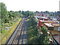
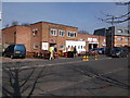
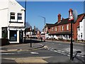
Your lifestyle as a resident of CV8 1RB benefits from direct access to essential services and retail outlets in Kenilworth. Three major supermarkets serve the town, including Waitrose Kenilworth, Sainsburys Kenilworth, and Iceland Kenilworth. These retail destinations provide high and budget grocery options within practical reach. For travel needs, the area is near two airports, with Coventry Airport listed as a primary nearby feature. This proximity allows for quick air travel when required, supplementing the car or train options available to you. The town also boasts five notable railway stations, giving you flexibility in choosing departure points for regional journeys. Dining and shopping on the high street are handled by these established chain stores and local provisions. Living in CV8 1RB means you do not need to travel far for weekly essentials or leisure trips. The combination of accessible rail links and comprehensive grocery shopping creates a convenient routine for daily life.
Amenities
Schools
Residential families in CV8 1RB have access to a focused selection of educational institutions within their immediate vicinity. The area is served by three primary schools: St John's Middle School, St John's First School, and St John's Primary School. St John's Primary School holds a good Ofsted rating, providing a verified standard of education for young children living nearby. The facility name appears repeatedly in local records, indicating its central role in the catchment area for this postcode. These primary institutions form the first phase of a child's education without offering secondary options directly on-site. Families must plan their routes carefully, as the listed academies cater specifically to younger pupils. The repetition of the St John's name across different levels of primary education suggests a dedicated educational cluster serving the town. You will find these schools listed as the definitive nearest options for families residing in CV8 1RB, with no secondary schools provided in the immediate data for this specific cluster.
| Rank | School | Type | Entry gender | Ages |
|---|
Explore more schools in this area
Go to Schools tabDemographics
The community in CV8 1RB displays clear demographic patterns typical of an established town area. The median age stands at 47 years, with the most populous group being adults between 30 and 64 years. This age profile suggests the area attracts families and steady professionals rather than young entrants to the housing market. Home ownership stands at 63%, indicating that the majority of residents have stakes in their local properties. The local accommodation type consists primarily of houses, reflecting a preference for detached or semi-detached living over urban flats. The predominant ethnic group in the area is White, aligning with the broader demographic structure of the Warwick District. These figures confirm a mature, stable community where long-term residents form the backbone of local society. You can expect a neighbourhood where house ownership is the norm, fostering a sense of permanence among the inhabitants. The concentration of adults in their prime working years also implies a workforce familiar with the local economy and amenities.
Household Size
Accommodation Type
Tenure
Ethnic Group
Religion
Household Composition
Age
Household Deprivation
NS-SEC
Explore more demographic insights in this area
Go to Demographics tabPlanning
Planning Constraints
- Flood RiskPremium
- Ramsar Wetland SitesPremium
- Area of Outstanding Natural BeautyPremium
- Protected Nature ReservePremium
- Protected WoodlandPremium