Area Overview for CV8 1HP
Photos of CV8 1HP
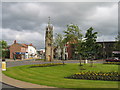
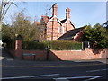
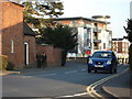
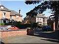
100 photos from this area
Area Information
Key information about the CV8 1HP including its size, population, and administrative classification.
- Area Type
- Postcode
- Area Size
- 4831 m²
- Population
- 1491
- Population Density
- 4712 people/km²
House Prices in CV8 1HP
34
Properties
£290,643
Average Sold Price
£71,000
Lowest Price
£810,000
Highest Price
Showing 34 properties
| Address | Type | Beds | Baths | Last Sale Price | Last Sale Date | |
|---|---|---|---|---|---|---|
| 97 Warwick Road, Kenilworth, CV8 1HP | Semi-detached | 5 | 3 | £810,000 | Jun 2021 | |
| 109 Warwick Road, Kenilworth, CV8 1HP | Terraced | 3 | 2 | £275,000 | Jun 2021 | |
| 107 Warwick Road, Kenilworth, CV8 1HP | Terraced | 2 | 1 | £220,000 | Oct 2020 | |
| 89 Warwick Road, Kenilworth, CV8 1HP | Semi-detached | 3 | - | £310,000 | Aug 2015 | |
| 91 Warwick Road, Kenilworth, CV8 1HP | house | 3 | - | £273,500 | Aug 2014 | |
| 115 Warwick Road, Kenilworth, CV8 1HP | Terraced | 1 | 1 | £71,000 | Jun 2001 | |
| 119 Warwick Road, Kenilworth, CV8 1HP | house | - | - | £75,000 | Oct 1999 | |
| Flat 1, 99 Warwick Road, Kenilworth, CV8 1HP | Flat | 1 | 1 | - | - | |
| 95 Warwick Road, Kenilworth, CV8 1HP | Semi-detached | 5 | 4 | - | - | |
| 121-123 Warwick Road, Kenilworth, CV8 1HP | Semi-detached | - | - | - | - |
Page 1 of 4
Energy Efficiency in CV8 1HP
Amenities
Schools
| Rank | School | Type | Entry gender | Ages |
|---|
Explore more schools in this area
Go to Schools tabDemographics
Household Size
One person
most common
Accommodation Type
Houses
most common
Tenure
63
majority
Ethnic Group
White
most common
Religion
N/A
most common
Household Composition
N/A
most common
Age
47
median
Adults (30-64 years)
most common
Household Deprivation
N/A
with no deprivation
NS-SEC
43
in Lower managerial occupations
Explore more demographic insights in this area
Go to Demographics tabPlanning
Planning Constraints
- Flood RiskPremium
- Ramsar Wetland SitesPremium
- Area of Outstanding Natural BeautyPremium
- Protected Nature ReservePremium
- Protected WoodlandPremium