Area Overview for CV8 1GR
Photos of CV8 1GR
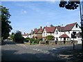


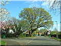
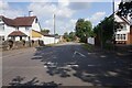
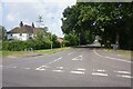
21 photos from this area
Area Information
Key information about the CV8 1GR including its size, population, and administrative classification.
- Area Type
- Postcode
- Area Size
- 1.9 hectares
- Population
- 1507
- Population Density
- 4857 people/km²
House Prices in CV8 1GR
43
Properties
£230,600
Average Sold Price
£46,500
Lowest Price
£365,000
Highest Price
Showing 43 properties
| Address | Type | Beds | Baths | Last Sale Price | Last Sale Date | |
|---|---|---|---|---|---|---|
| 129 Dudley Road, Kenilworth, CV8 1GR | Terraced | 3 | 1 | £265,000 | Feb 2025 | |
| 63 Dudley Road, Kenilworth, CV8 1GR | Terraced | 3 | 2 | £355,000 | Feb 2025 | |
| 91 Dudley Road, Kenilworth, CV8 1GR | Terraced | 3 | 1 | £340,000 | Mar 2024 | |
| 83 Dudley Road, Kenilworth, CV8 1GR | Terraced | 3 | 1 | £315,000 | Nov 2022 | |
| 105 Dudley Road, Kenilworth, CV8 1GR | house | - | - | £313,000 | Feb 2022 | |
| 99 Dudley Road, Kenilworth, CV8 1GR | house | 3 | 2 | £319,950 | Jun 2021 | |
| 93 Dudley Road, Kenilworth, CV8 1GR | Terraced | 3 | 1 | £240,000 | Mar 2021 | |
| 53 Dudley Road, Kenilworth, CV8 1GR | house | - | - | £320,000 | Feb 2021 | |
| 75 Dudley Road, Kenilworth, CV8 1GR | house | - | - | £315,000 | Aug 2019 | |
| 103 Dudley Road, Kenilworth, CV8 1GR | Terraced | 3 | 1 | £332,500 | Mar 2019 |
Page 1 of 5
Energy Efficiency in CV8 1GR
Amenities
Schools
| Rank | School | Type | Entry gender | Ages |
|---|
Explore more schools in this area
Go to Schools tabDemographics
Household Size
Family (3-5 people)
most common
Accommodation Type
Houses
most common
Tenure
86
majority
Ethnic Group
White
most common
Religion
N/A
most common
Household Composition
N/A
most common
Age
47
median
Adults (30-64 years)
most common
Household Deprivation
N/A
with no deprivation
NS-SEC
42
in Lower managerial occupations
Explore more demographic insights in this area
Go to Demographics tabPlanning
Planning Constraints
- Flood RiskPremium
- Ramsar Wetland SitesPremium
- Area of Outstanding Natural BeautyPremium
- Protected Nature ReservePremium
- Protected WoodlandPremium