Area Overview for CV8 1FP
Photos of CV8 1FP
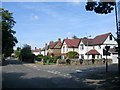

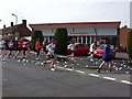
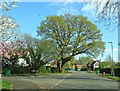
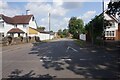
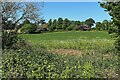
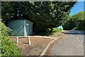
21 photos from this area
Area Information
Key information about the CV8 1FP including its size, population, and administrative classification.
- Area Type
- Postcode
- Area Size
- 7.8 hectares
- Population
- 1430
- Population Density
- 450 people/km²
House Prices in CV8 1FP
18
Properties
£472,143
Average Sold Price
£200,000
Lowest Price
£755,000
Highest Price
Showing 18 properties
| Address | Type | Beds | Baths | Last Sale Price | Last Sale Date | |
|---|---|---|---|---|---|---|
| 121 Rouncil Lane, Kenilworth, CV8 1FP | Detached | 4 | 2 | £755,000 | May 2024 | |
| 109 Rouncil Lane, Kenilworth, CV8 1FP | Detached | 5 | 3 | £645,000 | Jan 2017 | |
| 111 Rouncil Lane, Kenilworth, CV8 1FP | Detached | 5 | - | £427,500 | May 2013 | |
| 112 Rouncil Lane, Kenilworth, CV8 1FP | Bungalow | 3 | - | £530,000 | Nov 2010 | |
| 114 Rouncil Lane, Kenilworth, CV8 1FP | house | - | - | £355,000 | Oct 2009 | |
| 107 Rouncil Lane, Kenilworth, CV8 1FP | Detached | - | - | £392,500 | Jul 2003 | |
| 113 Rouncil Lane, Kenilworth, CV8 1FP | Detached | - | - | £200,000 | May 1996 | |
| Alvista, 118 Rouncil Lane, Kenilworth, CV8 1FP | Retail | 4 | 2 | - | - | |
| 101 Rouncil Lane, Kenilworth, CV8 1FP | Land | - | - | - | - | |
| Mobile Home, 114 Rouncil Lane, Kenilworth, CV8 1FP | Mobile Home | - | - | - | - |
Page 1 of 2
Energy Efficiency in CV8 1FP
Amenities
Schools
| Rank | School | Type | Entry gender | Ages |
|---|
Explore more schools in this area
Go to Schools tabDemographics
Household Size
Two person
most common
Accommodation Type
Houses
most common
Tenure
78
majority
Ethnic Group
White
most common
Religion
N/A
most common
Household Composition
N/A
most common
Age
47
median
Adults (30-64 years)
most common
Household Deprivation
N/A
with no deprivation
NS-SEC
43
in Lower managerial occupations
Explore more demographic insights in this area
Go to Demographics tabPlanning
Planning Constraints
- Flood RiskPremium
- Ramsar Wetland SitesPremium
- Area of Outstanding Natural BeautyPremium
- Protected Nature ReservePremium
- Protected WoodlandPremium