Area Overview for CV8 1ET
Photos of CV8 1ET
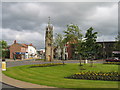
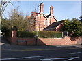
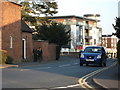
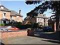
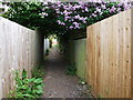
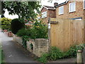
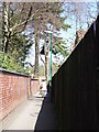
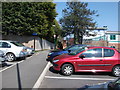
100 photos from this area
Area Information
Key information about the CV8 1ET including its size, population, and administrative classification.
- Area Type
- Postcode
- Area Size
- 4.8 hectares
- Population
- 1663
- Population Density
- 1754 people/km²
House Prices in CV8 1ET
30
Properties
£404,204
Average Sold Price
£172,500
Lowest Price
£685,000
Highest Price
Showing 30 properties
| Address | Type | Beds | Baths | Last Sale Price | Last Sale Date | |
|---|---|---|---|---|---|---|
| 42 Brookside Avenue, Kenilworth, CV8 1ET | house | 5 | 1 | £685,000 | Sep 2024 | |
| 8 Brookside Avenue, Kenilworth, CV8 1ET | Detached | 3 | 2 | £540,000 | Apr 2024 | |
| 44 Brookside Avenue, Kenilworth, CV8 1ET | Detached | 3 | 1 | £560,000 | Jan 2024 | |
| 14 Brookside Avenue, Kenilworth, CV8 1ET | house | - | - | £475,000 | Nov 2023 | |
| 32 Brookside Avenue, Kenilworth, CV8 1ET | house | - | - | £510,000 | May 2022 | |
| 12 Brookside Avenue, Kenilworth, CV8 1ET | house | - | - | £495,000 | Feb 2022 | |
| 26 Brookside Avenue, Kenilworth, CV8 1ET | house | - | - | £685,000 | Aug 2021 | |
| 56 Brookside Avenue, Kenilworth, CV8 1ET | house | - | - | £466,000 | Jan 2021 | |
| 58 Brookside Avenue, Kenilworth, CV8 1ET | house | - | - | £485,000 | Jan 2020 | |
| 22 Brookside Avenue, Kenilworth, CV8 1ET | Detached | - | - | £475,000 | Sep 2017 |
Page 1 of 3
Energy Efficiency in CV8 1ET
Amenities
Schools
| Rank | School | Type | Entry gender | Ages |
|---|
Explore more schools in this area
Go to Schools tabDemographics
Household Size
Two person
most common
Accommodation Type
Houses
most common
Tenure
77
majority
Ethnic Group
White
most common
Religion
N/A
most common
Household Composition
N/A
most common
Age
47
median
Adults (30-64 years)
most common
Household Deprivation
N/A
with no deprivation
NS-SEC
58
in Lower managerial occupations
Explore more demographic insights in this area
Go to Demographics tabPlanning
Planning Constraints
- Flood RiskPremium
- Ramsar Wetland SitesPremium
- Area of Outstanding Natural BeautyPremium
- Protected Nature ReservePremium
- Protected WoodlandPremium