Area Overview for CV8 1DL
Photos of CV8 1DL
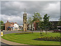
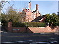
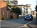
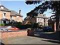
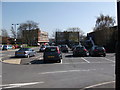
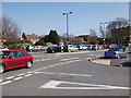
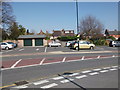
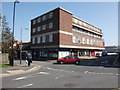
100 photos from this area
Area Information
Key information about the CV8 1DL including its size, population, and administrative classification.
- Area Type
- Postcode
- Area Size
- 2.4 hectares
- Population
- 1507
- Population Density
- 4857 people/km²
House Prices in CV8 1DL
40
Properties
£293,444
Average Sold Price
£88,000
Lowest Price
£510,000
Highest Price
Showing 40 properties
| Address | Type | Beds | Baths | Last Sale Price | Last Sale Date | |
|---|---|---|---|---|---|---|
| 14 Caesar Road, Kenilworth, CV8 1DL | house | 4 | 1 | £510,000 | Feb 2025 | |
| 28 Caesar Road, Kenilworth, CV8 1DL | Semi-detached | 3 | 1 | £360,000 | Aug 2024 | |
| 9 Caesar Road, Kenilworth, CV8 1DL | house | - | - | £285,000 | Mar 2024 | |
| 26 Caesar Road, Kenilworth, CV8 1DL | Semi-detached | 3 | 1 | £420,000 | Dec 2023 | |
| 38 Caesar Road, Kenilworth, CV8 1DL | house | - | - | £510,000 | Jul 2022 | |
| 7 Caesar Road, Kenilworth, CV8 1DL | house | 3 | - | £320,000 | Jun 2021 | |
| 35 Caesar Road, Kenilworth, CV8 1DL | Bungalow | - | - | £479,950 | Jan 2021 | |
| 17 Caesar Road, Kenilworth, CV8 1DL | house | - | - | £298,000 | Jun 2019 | |
| 11 Caesar Road, Kenilworth, CV8 1DL | house | - | - | £341,500 | Oct 2016 | |
| 40 Caesar Road, Kenilworth, CV8 1DL | Detached | 5 | 2 | £475,000 | Jan 2016 |
Page 1 of 4
Energy Efficiency in CV8 1DL
Amenities
Schools
| Rank | School | Type | Entry gender | Ages |
|---|
Explore more schools in this area
Go to Schools tabDemographics
Household Size
Family (3-5 people)
most common
Accommodation Type
Houses
most common
Tenure
86
majority
Ethnic Group
White
most common
Religion
N/A
most common
Household Composition
N/A
most common
Age
47
median
Adults (30-64 years)
most common
Household Deprivation
N/A
with no deprivation
NS-SEC
42
in Lower managerial occupations
Explore more demographic insights in this area
Go to Demographics tabPlanning
Planning Constraints
- Flood RiskPremium
- Ramsar Wetland SitesPremium
- Area of Outstanding Natural BeautyPremium
- Protected Nature ReservePremium
- Protected WoodlandPremium