Area Overview for CV7 9QF
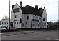
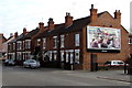
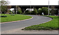
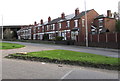
Photos of CV7 9QF


Area Information
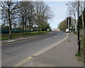
CV7 9QF is a small, densely populated residential postcode in England, home to 2,275 people spread across just 1.18 km². This compact area is characterised by a tight-knit community, with a high population density of 1,929 people per square kilometre. The area’s proximity to key infrastructure, including multiple railway stations and retail hubs, makes it accessible for commuters and shoppers alike. While the postcode itself is a single cluster of homes, it sits within a broader network of local amenities and transport links. The area’s demographic profile suggests a mature population, with a median age of 47 and a strong presence of adults aged 30–64. Daily life here is shaped by the balance between residential stability and practical connectivity, offering residents a mix of convenience and community. The absence of major environmental constraints, such as protected nature reserves or flood-prone zones, further underscores its appeal for those prioritising safety and ease of living. For buyers, CV7 9QF represents a focused opportunity to invest in a well-serviced, established neighbourhood.
- Area Type
- Postcode
- Area Size
- Not available
- Population
- 2275
- Population Density
- 1929 people/km²
The property market in CV7 9QF is dominated by owner-occupied homes, with 75% of residents living in properties they own. This high rate of home ownership suggests a stable, long-term community with limited rental activity. The accommodation type is primarily houses, which implies a mix of semi-detached and detached properties typical of suburban or rural settings. Given the area’s small size and high population density, the housing stock is likely to be older, with limited scope for new developments. For buyers, this means a focus on existing properties rather than new builds. The compact nature of the postcode also means that the immediate surrounding areas are critical for property availability. Buyers should consider the limited number of homes in the area and the potential for competition among local residents. The market’s character is defined by its established nature, making it suitable for those seeking a settled, family-oriented environment.
House Prices in CV7 9QF
No properties found in this postcode.
Energy Efficiency in CV7 9QF
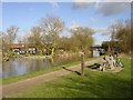
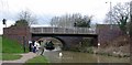
Living in CV7 9QF offers access to essential retail and transport hubs within practical reach. The area is served by five notable retail outlets, including Co-op Exhall, Sainsburys Bedworth, and Co-op Goodyers, providing everyday shopping needs. For commuters, five nearby railway stations—Coventry Arena, Bedworth, and Bermuda Park—offer convenient links to regional transport networks. While the area itself is small, its proximity to larger towns ensures residents can access a broader range of amenities. The lack of detailed data on local parks or leisure facilities means the area’s recreational offerings are not fully outlined, but its rail connectivity and retail options suggest a lifestyle focused on practicality and ease of access. For those prioritising convenience, CV7 9QF’s amenities align with a balanced approach to daily living, balancing proximity to services with a compact residential environment.
Amenities
Schools
| Rank | School | Type | Entry gender | Ages |
|---|
Explore more schools in this area
Go to Schools tabDemographics
The community in CV7 9QF is predominantly composed of adults aged 30–64, with a median age of 47. This suggests a mature, settled population, likely with long-term ties to the area. Home ownership is high, with 75% of residents owning their homes, indicating a stable housing market and a preference for long-term residency. The accommodation type is primarily houses, reflecting a suburban or semi-rural character. The predominant ethnic group is White, which aligns with broader trends in the region. The absence of specific data on diversity or deprivation means the area’s social dynamics are not fully detailed, but the high home ownership rate and age profile suggest a community focused on family living and stability. The population density, while high, does not indicate overcrowding, as the area’s small size accommodates its 2,275 residents within a compact footprint.
Household Size
Accommodation Type
Tenure
Ethnic Group
Religion
Household Composition
Age
Household Deprivation
NS-SEC
Explore more demographic insights in this area
Go to Demographics tabPlanning
Planning Constraints
- Flood RiskPremium
- Ramsar Wetland SitesPremium
- Area of Outstanding Natural BeautyPremium
- Protected Nature ReservePremium
- Protected WoodlandPremium