Area Overview for CV7 9LD
Photos of CV7 9LD
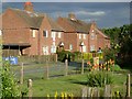
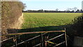
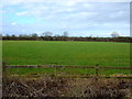
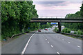
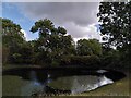
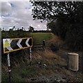
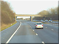
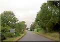
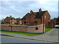
17 photos from this area
Area Information
Key information about the CV7 9LD including its size, population, and administrative classification.
- Area Type
- Postcode
- Area Size
- 48.8 hectares
- Population
- 1564
- Population Density
- 45 people/km²
House Prices in CV7 9LD
56
Properties
£263,273
Average Sold Price
£84,000
Lowest Price
£800,000
Highest Price
Showing 56 properties
| Address | Type | Beds | Baths | Last Sale Price | Last Sale Date | |
|---|---|---|---|---|---|---|
| The Gables, Lower Road, Barnacle, CV7 9LD | Detached | 4 | 2 | £800,000 | Dec 2025 | |
| 22 Lower Road, Barnacle, CV7 9LD | Bungalow | 2 | 1 | £280,000 | May 2025 | |
| 66 Lower Road, Barnacle, CV7 9LD | Terraced | 2 | 1 | £226,000 | Mar 2025 | |
| 68 Lower Road, Barnacle, CV7 9LD | Semi-detached | 3 | 1 | £285,000 | Jan 2025 | |
| Rosewood, Lower Road, Barnacle, CV7 9LD | Detached | 4 | 3 | £618,000 | Mar 2023 | |
| 72 Lower Road, Barnacle, CV7 9LD | Semi-detached | 3 | 2 | £395,000 | Mar 2023 | |
| 28 Lower Road, Barnacle, CV7 9LD | Bungalow | 3 | 1 | £330,000 | Oct 2019 | |
| Orchard House, Lower Road, Barnacle, CV7 9LD | Detached | 4 | 2 | £415,000 | Jul 2017 | |
| 62 Lower Road, Barnacle, CV7 9LD | Cottage | 2 | 1 | £149,000 | May 2017 | |
| 16 Lower Road, Barnacle, CV7 9LD | Bungalow | - | - | £200,000 | Apr 2016 |
Page 1 of 6
Energy Efficiency in CV7 9LD
Amenities
Schools
| Rank | School | Type | Entry gender | Ages |
|---|
Explore more schools in this area
Go to Schools tabDemographics
Household Size
Two person
most common
Accommodation Type
Houses
most common
Tenure
86
majority
Ethnic Group
White
most common
Religion
N/A
most common
Household Composition
N/A
most common
Age
47
median
Adults (30-64 years)
most common
Household Deprivation
N/A
with no deprivation
NS-SEC
38
in Lower managerial occupations
Explore more demographic insights in this area
Go to Demographics tabPlanning
Planning Constraints
- Flood RiskPremium
- Ramsar Wetland SitesPremium
- Area of Outstanding Natural BeautyPremium
- Protected Nature ReservePremium
- Protected WoodlandPremium