Area Overview for CV7 9JX
Photos of CV7 9JX
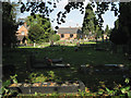
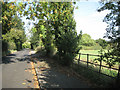
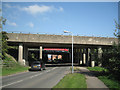
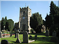

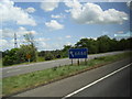

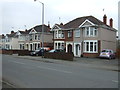
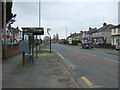

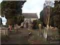
48 photos from this area
Area Information
Key information about the CV7 9JX including its size, population, and administrative classification.
- Area Type
- Postcode
- Area Size
- 6.9 hectares
- Population
- 1634
- Population Density
- 2242 people/km²
House Prices in CV7 9JX
87
Properties
£242,467
Average Sold Price
£182,000
Lowest Price
£306,950
Highest Price
Showing 87 properties
| Address | Type | Beds | Baths | Last Sale Price | Last Sale Date | |
|---|---|---|---|---|---|---|
| 1 Hall Green Drive, Exhall, Bedworth, CV7 9JX | house | - | - | £290,000 | Dec 2024 | |
| 102 Hall Green Drive, Exhall, Bedworth, CV7 9JX | house | - | - | £269,950 | Feb 2024 | |
| 80 Hall Green Drive, Exhall, Bedworth, CV7 9JX | Terraced | 3 | 1 | £249,950 | Jul 2023 | |
| 76 Hall Green Drive, Exhall, Bedworth, CV7 9JX | house | - | - | £237,950 | Jun 2023 | |
| 64 Hall Green Drive, Exhall, Bedworth, CV7 9JX | house | - | - | £195,965 | Apr 2023 | |
| 66 Hall Green Drive, Exhall, Bedworth, CV7 9JX | house | - | - | £279,950 | Apr 2023 | |
| 55 Hall Green Drive, Exhall, Bedworth, CV7 9JX | house | - | - | £191,065 | Mar 2023 | |
| 57 Hall Green Drive, Exhall, Bedworth, CV7 9JX | house | - | - | £182,000 | Mar 2023 | |
| 59 Hall Green Drive, Exhall, Bedworth, CV7 9JX | house | - | - | £191,065 | Mar 2023 | |
| 63 Hall Green Drive, Exhall, Bedworth, CV7 9JX | house | - | - | £194,565 | Mar 2023 |
Page 1 of 9
Energy Efficiency in CV7 9JX
Amenities
Schools
| Rank | School | Type | Entry gender | Ages |
|---|
Explore more schools in this area
Go to Schools tabDemographics
Household Size
One person
most common
Accommodation Type
Houses
most common
Tenure
61
majority
Ethnic Group
White
most common
Religion
N/A
most common
Household Composition
N/A
most common
Age
47
median
Adults (30-64 years)
most common
Household Deprivation
N/A
with no deprivation
NS-SEC
21
in Lower managerial occupations
Explore more demographic insights in this area
Go to Demographics tabPlanning
Planning Constraints
- Flood RiskPremium
- Ramsar Wetland SitesPremium
- Area of Outstanding Natural BeautyPremium
- Protected Nature ReservePremium
- Protected WoodlandPremium