Area Overview for CV7 9GJ
Photos of CV7 9GJ
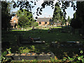
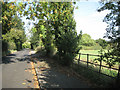
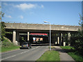


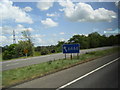


48 photos from this area
Area Information
Key information about the CV7 9GJ including its size, population, and administrative classification.
- Area Type
- Postcode
- Area Size
- 2.1 hectares
- Population
- 1568
- Population Density
- 3822 people/km²
House Prices in CV7 9GJ
37
Properties
£171,180
Average Sold Price
£62,500
Lowest Price
£325,000
Highest Price
Showing 37 properties
| Address | Type | Beds | Baths | Last Sale Price | Last Sale Date | |
|---|---|---|---|---|---|---|
| 27 Davies Road, Exhall, Bedworth, CV7 9GJ | Detached | 4 | 1 | £295,000 | Aug 2025 | |
| 22 Davies Road, Exhall, Bedworth, CV7 9GJ | Detached | 4 | 1 | £313,000 | Feb 2025 | |
| 15 Davies Road, Exhall, Bedworth, CV7 9GJ | Semi-detached | 4 | 2 | £325,000 | Oct 2023 | |
| 33 Davies Road, Exhall, Bedworth, CV7 9GJ | house | - | - | £286,000 | May 2022 | |
| 29 Davies Road, Exhall, Bedworth, CV7 9GJ | house | - | - | £259,000 | Aug 2021 | |
| 34 Davies Road, Exhall, Bedworth, CV7 9GJ | Detached | 4 | 1 | £225,000 | Jan 2021 | |
| 31 Davies Road, Exhall, Bedworth, CV7 9GJ | house | - | - | £195,000 | Nov 2018 | |
| 35 Davies Road, Exhall, Bedworth, CV7 9GJ | house | - | - | £230,000 | May 2018 | |
| 7 Davies Road, Exhall, Bedworth, CV7 9GJ | Bungalow | 2 | 1 | £175,000 | May 2018 | |
| 9 Davies Road, Exhall, Bedworth, CV7 9GJ | Bungalow | - | - | £124,000 | Apr 2015 |
Page 1 of 4
Energy Efficiency in CV7 9GJ
Amenities
Schools
| Rank | School | Type | Entry gender | Ages |
|---|
Explore more schools in this area
Go to Schools tabDemographics
Household Size
Two person
most common
Accommodation Type
Houses
most common
Tenure
69
majority
Ethnic Group
White
most common
Religion
N/A
most common
Household Composition
N/A
most common
Age
47
median
Adults (30-64 years)
most common
Household Deprivation
N/A
with no deprivation
NS-SEC
21
in Lower managerial occupations
Explore more demographic insights in this area
Go to Demographics tabPlanning
Planning Constraints
- Flood RiskPremium
- Ramsar Wetland SitesPremium
- Area of Outstanding Natural BeautyPremium
- Protected Nature ReservePremium
- Protected WoodlandPremium