Area Overview for CV7 9FT
Photos of CV7 9FT


Area Information
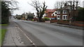
CV7 9FT is a compact residential postcode in England, covering 1.2 hectares and home to 2,275 people. Its small size means it is a tightly knit community, with a population density of 1,929 people per square kilometre. The area is characterised by a mature demographic, with a median age of 47 and the majority of residents falling within the 30–64 age range. This suggests a stable, established community with a focus on family life and long-term residency. The area is primarily composed of houses, with 75% of homes owned outright, indicating a strong sense of local permanence. While the postcode itself is small, it benefits from proximity to nearby amenities such as retail outlets and railway stations, offering a balance of residential tranquillity and practical connectivity. The low flood risk and absence of environmental constraints like protected woodlands or Areas of Outstanding Natural Beauty make it an attractive option for those seeking a settled lifestyle without ecological restrictions. However, the moderate crime risk score of 53 means residents should remain vigilant about standard security measures.
- Area Type
- Postcode
- Area Size
- 1.2 hectares
- Population
- 2275
- Population Density
- 1929 people/km²
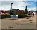
The property market in CV7 9FT is dominated by owner-occupied homes, with 75% of properties owned outright. This high rate of home ownership suggests a community with long-term residency and a focus on stability rather than rental investment. The accommodation type is primarily houses, which are more common than flats or other forms of housing. Given the area’s small size—just 1.2 hectares—the housing stock is limited, meaning buyers may need to consider nearby postcodes for more options. The concentration of houses implies a traditional, family-oriented environment, with properties likely to be larger and more private than in high-density areas. For buyers, this means a market that values permanence and established neighborhoods, though the limited size of CV7 9FT itself may require looking beyond the immediate postcode for additional choices.
House Prices in CV7 9FT
Showing 1 properties
| Address | Type | Beds | Baths | Last Sale Price | Last Sale Date | |
|---|---|---|---|---|---|---|
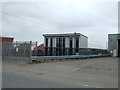
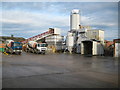
| Chinn Aerospace, Factory B, 73 Coventry Road, Exhall, Bedworth, CV7 9FT | Industrial | - | - | - | - |
Energy Efficiency in CV7 9FT
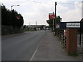
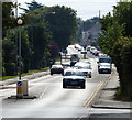
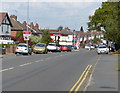
Living in CV7 9FT offers access to a range of local amenities within practical reach. Retail options include Co-op Exhall, Sainsburys Bedworth, and Co-op Goodyers, providing essential shopping and services. The area’s railway stations—Coventry Arena, Bedworth, and Bermuda Park—offer convenient transport links for commuting or leisure travel. Recreational opportunities are also available, with Miners Welfare Park featuring floodlit tennis and netball courts, a football pitch, and a cricket ground. Nearby, The Oval (CV12 8NN) and Johnson Road Recreation Ground (CV12 9BH) provide additional sports facilities, while St Michael’s CofE Academy (CV12 9DA) hosts youth football pitches. These amenities contribute to a lifestyle that balances community engagement with personal leisure, making CV7 9FT suitable for those who value both convenience and active outdoor pursuits.
Amenities
Schools
| Rank | School | Type | Entry gender | Ages |
|---|
Explore more schools in this area
Go to Schools tabDemographics
The population of CV7 9FT is predominantly composed of adults aged 30–64, with a median age of 47. This suggests a community that is largely in its prime working years, likely with established careers and family commitments. Home ownership is high at 75%, with the majority of properties being houses rather than flats or apartments. The predominant ethnic group is White, reflecting a homogenous demographic profile. The population density of 1,929 people per square kilometre indicates a relatively compact settlement, which can foster a close-knit community but may also contribute to higher demand for local amenities. The absence of specific data on deprivation or diversity means the area’s social fabric is not fully detailed, but the high home ownership rate and mature age profile imply a stable, low-turnover environment. This demographic structure may influence the character of local services and the pace of change in the area.
Household Size
Accommodation Type
Tenure
Ethnic Group
Religion
Household Composition
Age
Household Deprivation
NS-SEC
Explore more demographic insights in this area
Go to Demographics tabPlanning
Planning Constraints
- Flood RiskPremium
- Ramsar Wetland SitesPremium
- Area of Outstanding Natural BeautyPremium
- Protected Nature ReservePremium
- Protected WoodlandPremium