Area Overview for CV7 9AD
Photos of CV7 9AD
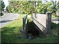
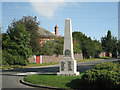
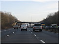
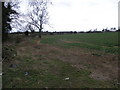
34 photos from this area
Area Information
Key information about the CV7 9AD including its size, population, and administrative classification.
- Area Type
- Postcode
- Area Size
- 1.2 hectares
- Population
- 1408
- Population Density
- 693 people/km²
House Prices in CV7 9AD
26
Properties
£123,450
Average Sold Price
£39,750
Lowest Price
£205,000
Highest Price
Showing 26 properties
| Address | Type | Beds | Baths | Last Sale Price | Last Sale Date | |
|---|---|---|---|---|---|---|
| 67 Vicarage Lane, Ash Green, Bedworth, CV7 9AD | house | - | - | £205,000 | May 2021 | |
| 103 Vicarage Lane, Ash Green, Bedworth, CV7 9AD | house | - | - | £190,000 | Mar 2020 | |
| 89 Vicarage Lane, Ash Green, Bedworth, CV7 9AD | Terraced | 3 | 1 | £180,000 | Oct 2019 | |
| 61 Vicarage Lane, Ash Green, Bedworth, CV7 9AD | house | - | - | £175,000 | Jun 2019 | |
| 97 Vicarage Lane, Ash Green, Bedworth, CV7 9AD | house | - | - | £142,500 | Aug 2018 | |
| 83 Vicarage Lane, Ash Green, Bedworth, CV7 9AD | house | - | - | £120,000 | Jul 2017 | |
| 57 Vicarage Lane, Ash Green, Bedworth, CV7 9AD | house | - | - | £155,000 | Mar 2017 | |
| 71 Vicarage Lane, Ash Green, Bedworth, CV7 9AD | Terraced | 3 | - | £125,000 | Dec 2013 | |
| 95 Vicarage Lane, Ash Green, Bedworth, CV7 9AD | house | 3 | - | £128,000 | Oct 2011 | |
| 79 Vicarage Lane, Ash Green, Bedworth, CV7 9AD | Terraced | - | - | £85,000 | Jul 2009 |
Page 1 of 3
Energy Efficiency in CV7 9AD
Amenities
Schools
| Rank | School | Type | Entry gender | Ages |
|---|
Explore more schools in this area
Go to Schools tabDemographics
Household Size
Two person
most common
Accommodation Type
Houses
most common
Tenure
89
majority
Ethnic Group
White
most common
Religion
N/A
most common
Household Composition
N/A
most common
Age
47
median
Adults (30-64 years)
most common
Household Deprivation
N/A
with no deprivation
NS-SEC
28
in Lower managerial occupations
Explore more demographic insights in this area
Go to Demographics tabPlanning
Planning Constraints
- Flood RiskPremium
- Ramsar Wetland SitesPremium
- Area of Outstanding Natural BeautyPremium
- Protected Nature ReservePremium
- Protected WoodlandPremium