Area Overview for CV7 8GZ
Photos of CV7 8GZ


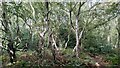

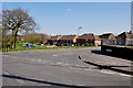
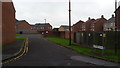


8 photos from this area
Area Information
Key information about the CV7 8GZ including its size, population, and administrative classification.
- Area Type
- Postcode
- Area Size
- 5943 m²
- Population
- 1481
- Population Density
- 1019 people/km²
House Prices in CV7 8GZ
21
Properties
£83,226
Average Sold Price
£35,500
Lowest Price
£165,000
Highest Price
Showing 21 properties
| Address | Type | Beds | Baths | Last Sale Price | Last Sale Date | |
|---|---|---|---|---|---|---|
| 4A Ransome Road, Arley, CV7 8GZ | Terraced | 2 | 1 | £165,000 | Jul 2025 | |
| 2B Ransome Road, Arley, CV7 8GZ | house | - | - | £86,500 | Dec 2020 | |
| 24 Ransome Road, Arley, CV7 8GZ | Terraced | 3 | 2 | £118,000 | Mar 2020 | |
| 6A Ransome Road, Arley, CV7 8GZ | Terraced | 2 | 1 | £105,000 | Jul 2016 | |
| 8 Ransome Road, Arley, CV7 8GZ | Terraced | 2 | - | £75,000 | Mar 2016 | |
| 4 Ransome Road, Arley, CV7 8GZ | house | - | - | £55,500 | Mar 2011 | |
| 26 Ransome Road, Arley, CV7 8GZ | Terraced | 3 | 1 | £75,000 | Jun 2010 | |
| 2A Ransome Road, Arley, CV7 8GZ | house | - | - | £87,500 | Oct 2009 | |
| 14 Ransome Road, Arley, CV7 8GZ | Terraced | - | - | £101,500 | Feb 2007 | |
| 12 Ransome Road, Arley, CV7 8GZ | Terraced | - | - | £51,950 | Apr 2003 |
Page 1 of 3
Energy Efficiency in CV7 8GZ
Amenities
Schools
| Rank | School | Type | Entry gender | Ages |
|---|
Explore more schools in this area
Go to Schools tabDemographics
Household Size
One person
most common
Accommodation Type
Houses
most common
Tenure
66
majority
Ethnic Group
White
most common
Religion
N/A
most common
Household Composition
N/A
most common
Age
47
median
Adults (30-64 years)
most common
Household Deprivation
N/A
with no deprivation
NS-SEC
28
in Lower managerial occupations
Explore more demographic insights in this area
Go to Demographics tabPlanning
Planning Constraints
- Flood RiskPremium
- Ramsar Wetland SitesPremium
- Area of Outstanding Natural BeautyPremium
- Protected Nature ReservePremium
- Protected WoodlandPremium