Area Overview for CV7 8FZ
Photos of CV7 8FZ
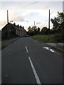
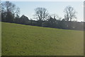
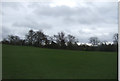
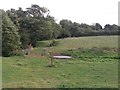
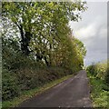
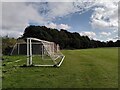
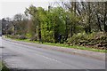
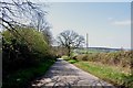
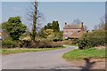
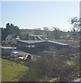
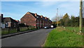
11 photos from this area
Area Information
Key information about the CV7 8FZ including its size, population, and administrative classification.
- Area Type
- Postcode
- Area Size
- 5.9 hectares
- Population
- 1614
- Population Density
- 290 people/km²
House Prices in CV7 8FZ
44
Properties
£91,590
Average Sold Price
£29,950
Lowest Price
£205,000
Highest Price
Showing 44 properties
| Address | Type | Beds | Baths | Last Sale Price | Last Sale Date | |
|---|---|---|---|---|---|---|
| 36 Hill Top, Arley, CV7 8FZ | house | 2 | - | £112,000 | Oct 2018 | |
| 5 Hill Top, Arley, CV7 8FZ | house | - | - | £93,000 | Aug 2015 | |
| 44 Hill Top, Arley, CV7 8FZ | house | - | - | £109,000 | May 2015 | |
| 43 Hill Top, Arley, CV7 8FZ | Terraced | 2 | 1 | £147,950 | Dec 2014 | |
| 24 Hill Top, Arley, CV7 8FZ | house | 2 | - | £80,000 | Jan 2012 | |
| 32 Hill Top, Arley, CV7 8FZ | Terraced | - | - | £39,000 | Mar 2009 | |
| 11 Hill Top, Arley, CV7 8FZ | house | - | - | £63,000 | Jan 2007 | |
| 45 Hill Top, Arley, CV7 8FZ | Detached | - | - | £205,000 | Jun 2002 | |
| 10 Hill Top, Arley, CV7 8FZ | Terraced | - | - | £37,000 | Feb 2000 | |
| 42 Hill Top, Arley, CV7 8FZ | Terraced | - | - | £29,950 | Jul 1997 |
Page 1 of 5
Energy Efficiency in CV7 8FZ
Amenities
Schools
| Rank | School | Type | Entry gender | Ages |
|---|
Explore more schools in this area
Go to Schools tabDemographics
Household Size
Two person
most common
Accommodation Type
Houses
most common
Tenure
63
majority
Ethnic Group
White
most common
Religion
N/A
most common
Household Composition
N/A
most common
Age
47
median
Adults (30-64 years)
most common
Household Deprivation
N/A
with no deprivation
NS-SEC
26
in Lower managerial occupations
Explore more demographic insights in this area
Go to Demographics tabPlanning
Planning Constraints
- Flood RiskPremium
- Ramsar Wetland SitesPremium
- Area of Outstanding Natural BeautyPremium
- Protected Nature ReservePremium
- Protected WoodlandPremium