Area Overview for CV7 8FG
Photos of CV7 8FG
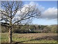
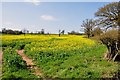
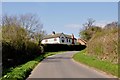
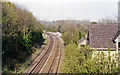
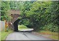
9 photos from this area
Area Information
Key information about the CV7 8FG including its size, population, and administrative classification.
- Area Type
- Postcode
- Area Size
- 41.9 hectares
- Population
- 1281
- Population Density
- 98 people/km²
House Prices in CV7 8FG
25
Properties
£289,886
Average Sold Price
£118,000
Lowest Price
£790,000
Highest Price
Showing 25 properties
| Address | Type | Beds | Baths | Last Sale Price | Last Sale Date | |
|---|---|---|---|---|---|---|
| Westbourne, Station Road, Arley, CV7 8FG | Bungalow | 6 | - | £790,000 | Feb 2022 | |
| The Beehives, Station Road, Arley, CV7 8FG | Bungalow | - | - | £350,000 | Aug 2021 | |
| The Cedars, Station Road, Arley, CV7 8FG | Bungalow | 2 | 1 | £275,000 | Dec 2016 | |
| Drogeada, Station Road, Arley, CV7 8FG | Bungalow | 2 | - | £272,500 | Aug 2016 | |
| Slovenia, Station Road, Arley, CV7 8FG | Bungalow | 4 | 3 | £242,000 | Jun 2015 | |
| Three Elms, Station Road, Arley, CV7 8FG | Bungalow | 2 | - | £270,000 | Feb 2014 | |
| Cartref, Station Road, Arley, CV7 8FG | Bungalow | 3 | 1 | £210,000 | Jun 2011 | |
| Field View, Station Road, Arley, CV7 8FG | Equestrian | 4 | 2 | £190,000 | Mar 2010 | |
| Lyngard, Station Road, Arley, CV7 8FG | Detached | - | - | £284,250 | Aug 2007 | |
| Brooklands House, Station Road, Arley, CV7 8FG | house | - | - | £187,000 | Jun 2000 |
Page 1 of 3
Energy Efficiency in CV7 8FG
Amenities
Schools
| Rank | School | Type | Entry gender | Ages |
|---|
Explore more schools in this area
Go to Schools tabDemographics
Household Size
Two person
most common
Accommodation Type
Houses
most common
Tenure
86
majority
Ethnic Group
White
most common
Religion
N/A
most common
Household Composition
N/A
most common
Age
47
median
Adults (30-64 years)
most common
Household Deprivation
N/A
with no deprivation
NS-SEC
37
in Lower managerial occupations
Explore more demographic insights in this area
Go to Demographics tabPlanning
Planning Constraints
- Flood RiskPremium
- Ramsar Wetland SitesPremium
- Area of Outstanding Natural BeautyPremium
- Protected Nature ReservePremium
- Protected WoodlandPremium