Area Overview for CV7 7DG
Photos of CV7 7DG
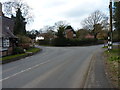
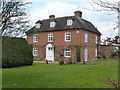
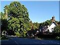
28 photos from this area
Area Information
Key information about the CV7 7DG including its size, population, and administrative classification.
- Area Type
- Postcode
- Area Size
- 41.2 hectares
- Population
- 1880
- Population Density
- 237 people/km²
House Prices in CV7 7DG
24
Properties
£407,786
Average Sold Price
£210,000
Lowest Price
£707,500
Highest Price
Showing 24 properties
| Address | Type | Beds | Baths | Last Sale Price | Last Sale Date | |
|---|---|---|---|---|---|---|
| The Pines, Hodgetts Lane, Berkswell, Solihull, CV7 7DG | Flat | - | - | £707,500 | Jan 2019 | |
| Avondale, Hodgetts Lane, Berkswell, Solihull, CV7 7DG | house | 5 | - | £425,000 | Dec 2017 | |
| Penard, Hodgetts Lane, Berkswell, Solihull, CV7 7DG | Detached | 4 | - | £475,000 | May 2013 | |
| Willows, Hodgetts Lane, Berkswell, Solihull, CV7 7DG | house | - | - | £460,000 | Mar 2012 | |
| Rainga, Hodgetts Lane, Berkswell, Solihull, CV7 7DG | Detached | - | - | £355,000 | Mar 2009 | |
| Briar Hayes, Hodgetts Lane, Berkswell, Solihull, CV7 7DG | Detached | - | - | £210,000 | Oct 1998 | |
| Stonehouse, Hodgetts Lane, Berkswell, Solihull, CV7 7DG | house | - | - | £222,000 | Oct 1996 | |
| Beechwood Farm House, Hodgetts Lane, Berkswell, Solihull, CV7 7DG | house | 6 | 3 | - | - | |
| Fair Acre, Beechwood Farm, Hodgetts Lane, Berkswell, Solihull, CV7 7DG | Detached | 3 | 2 | - | - | |
| Beechwood Cottage, Hodgetts Lane, Berkswell, Solihull, CV7 7DG | Detached | 4 | 5 | - | - |
Page 1 of 3
Energy Efficiency in CV7 7DG
Amenities
Schools
| Rank | School | Type | Entry gender | Ages |
|---|
Explore more schools in this area
Go to Schools tabDemographics
Household Size
Family (3-5 people)
most common
Accommodation Type
Houses
most common
Tenure
87
majority
Ethnic Group
White
most common
Religion
N/A
most common
Household Composition
N/A
most common
Age
47
median
Adults (30-64 years)
most common
Household Deprivation
N/A
with no deprivation
NS-SEC
50
in Lower managerial occupations
Explore more demographic insights in this area
Go to Demographics tabPlanning
Planning Constraints
- Flood RiskPremium
- Ramsar Wetland SitesPremium
- Area of Outstanding Natural BeautyPremium
- Protected Nature ReservePremium
- Protected WoodlandPremium