Area Overview for CV6 9PB
Photos of CV6 9PB


Area Information
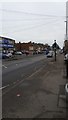
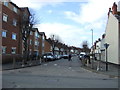
CV6 9PB is a small residential cluster in the northern reaches of Coventry, nestled within Foleshill Ward. With a population of 1,723, it reflects a compact, tightly knit community shaped by its industrial heritage. Historically a rural parish linked to the Domesday Book, the area now forms part of Coventry’s built-up fabric, centred on Foleshill Road (A444). Daily life here is influenced by its proximity to transport routes, including the Coventry-Nuneaton railway line, and its mix of retail and industrial remnants. The area’s character is defined by its post-war demographic shifts, with a majority non-white population and a legacy of manufacturing. Residents benefit from nearby schools, rail links, and a range of local amenities, though the community remains grounded in its working-class roots. The postcode’s small size means it is a microcosm of Coventry’s broader story—industrial past, evolving demographics, and a pragmatic approach to modern living.
- Area Type
- Postcode
- Area Size
- Not available
- Population
- Not available
- Population Density
- Not available
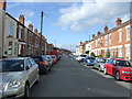
The property market in CV6 9PB is characterised by a low home ownership rate of 37%, suggesting that most residents rent rather than own their homes. This contrasts with areas where owner-occupation is more prevalent, and may reflect broader economic or housing supply challenges. The accommodation type is predominantly houses, which is notable given the postcode’s small size. This implies a mix of semi-detached or terraced housing, typical of older industrial suburbs. For buyers, the limited number of properties available in this small area means competition may be fierce, particularly for homes in good condition. The rental market is likely active, but prospective buyers should consider the long-term viability of property investment in a region with limited new development. The focus on houses rather than flats may also influence demand from families seeking space.
House Prices in CV6 9PB
No properties found in this postcode.
Energy Efficiency in CV6 9PB
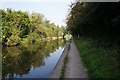
The lifestyle in CV6 9PB is shaped by its proximity to retail, dining, and transport hubs. Within walking distance are five retail outlets, including Lidl Edgwick, Morrisons Daily, and Aldi Edgwick, providing everyday shopping convenience. The area’s rail network connects residents to Coventry’s cultural and commercial centres, while the presence of two airports nearby—Coventry Airport—adds to its transport versatility. Though specific parks or leisure facilities are not listed, the area’s historical industrial sites and remnants of heathland geography, such as Little Heath, suggest potential for green spaces. The mix of retail and transport options supports a practical, community-focused lifestyle, with amenities prioritising functionality over luxury. However, the lack of explicit details on leisure facilities means residents may need to travel further for recreational activities.
Amenities
Schools
Residents of CV6 9PB have access to two notable schools within practical reach. Edgewick Community Primary School is a state-funded primary school with a ‘good’ Ofsted rating, offering a solid foundation for young learners. Nearby, Lote Tree Primary School is an independent institution also rated ‘good’ by Ofsted, providing an alternative for families seeking private education. The mix of school types allows parents to choose between public and private options, though both institutions share a commitment to quality education. The presence of two schools within the area reduces the need for long commutes, which is a practical advantage for working parents. However, the absence of secondary schools in the immediate vicinity means students may need to travel further for secondary education, a factor to consider for families planning long-term residency.
| Rank | School | Type | Entry gender | Ages |
|---|
Explore more schools in this area
Go to Schools tabDemographics
The population of CV6 9PB has a median age of 47, with the most common age range being adults aged 30–64. This suggests a mature, stable community with a strong presence of working-age residents. Home ownership here is low at 37%, indicating a rental-dominated market, which may reflect economic pressures or historical patterns of housing tenure. The predominant accommodation type is houses, though the exact distribution of household types is not specified. The area’s predominant ethnic group is the Asian total, highlighting its cultural diversity. This demographic profile shapes the area’s social dynamics, with a focus on family-oriented living and community cohesion. The absence of specific deprivation data means quality of life factors such as access to services and employment opportunities must be inferred from the available amenities and infrastructure.
Household Size
Accommodation Type
Tenure
Ethnic Group
Religion
Household Composition
Age
Household Deprivation
NS-SEC
Explore more demographic insights in this area
Go to Demographics tabPlanning
Planning Constraints
- Flood RiskPremium
- Ramsar Wetland SitesPremium
- Area of Outstanding Natural BeautyPremium
- Protected Nature ReservePremium
- Protected WoodlandPremium