Area Overview for CV6 6WR
Photos of CV6 6WR


Area Information
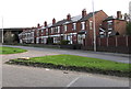
CV6 6WR is a small residential postcode area in England, characterised by a compact population of 2275 people spread across a densely populated region. This area is distinct for its mix of established housing and proximity to key transport links. The median age of 47 suggests a community of mature residents, many of whom are in the 30-64 age bracket, reflecting a settled demographic. Daily life here is shaped by the area’s practical layout, with homes predominantly in private ownership and a focus on local amenities. While the postcode covers a limited physical footprint, it connects residents to nearby towns and services. The area’s appeal lies in its balance of residential tranquillity and access to essential infrastructure, though its small size means housing options are limited. For those seeking a quiet, established neighbourhood with straightforward access to retail, transport, and community facilities, CV6 6WR offers a focused, manageable living environment.
- Area Type
- Postcode
- Area Size
- Not available
- Population
- 2275
- Population Density
- 1929 people/km²
The property market in CV6 6WR is dominated by owner-occupied homes, with 75% of properties in private hands. This indicates a stable, long-term resident base rather than a transient rental market. The accommodation type is primarily houses, which contrasts with areas where flats or apartments predominate. Given the small size of the postcode, the housing stock is likely limited, with few new developments. For buyers, this means a focus on existing properties, often in established, family-friendly layouts. The high home ownership rate suggests lower demand for rental properties, though the area’s proximity to transport links may attract commuters. However, the small footprint of CV6 6WR means that buyers should consider nearby areas for additional options. The market is likely characterised by steady, modest growth rather than rapid change.
House Prices in CV6 6WR
No properties found in this postcode.
Energy Efficiency in CV6 6WR
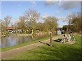
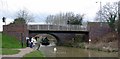
Living in CV6 6WR provides access to essential retail and transport hubs. Nearby, residents can shop at Co-op Exhall, Sainsburys Bedworth, and the M&S Arena, ensuring a range of daily necessities and leisure options. Rail stations like Coventry Arena and Bedworth offer straightforward links to surrounding areas, while Coventry Airport provides regional travel possibilities. The area’s compact nature means amenities are within practical reach, though the absence of detailed park or recreational data suggests a focus on local retail and transport over expansive green spaces. For those prioritising convenience and connectivity, CV6 6WR’s proximity to services and transport makes it a functional choice. However, the small postcode size limits the variety of leisure options, with residents likely relying on nearby towns for more extensive recreational facilities.
Amenities
Schools
| Rank | School | Type | Entry gender | Ages |
|---|
Explore more schools in this area
Go to Schools tabDemographics
The population of CV6 6WR is 2275, with a density of 1929 people per square kilometre, indicating a closely packed residential cluster. The median age of 47 and the most common age range of 30-64 years reflect a community of older adults and middle-aged residents, suggesting stability and long-term settlement. Home ownership is high, with 75% of properties in private hands, and the accommodation type is predominantly houses, which aligns with a more traditional, family-oriented housing stock. The predominant ethnic group is White, though specific data on diversity is not provided. The population density, while high, does not indicate overcrowding but rather a compact, efficient use of space. This demographic profile suggests a neighbourhood where older residents and families coexist, with limited turnover and a focus on long-term residency.
Household Size
Accommodation Type
Tenure
Ethnic Group
Religion
Household Composition
Age
Household Deprivation
NS-SEC
Explore more demographic insights in this area
Go to Demographics tabPlanning
Planning Constraints
- Flood RiskPremium
- Ramsar Wetland SitesPremium
- Area of Outstanding Natural BeautyPremium
- Protected Nature ReservePremium
- Protected WoodlandPremium