Area Overview for CV6 6EU
Photos of CV6 6EU

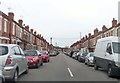
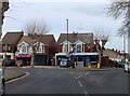
95 photos from this area
Area Information
Key information about the CV6 6EU including its size, population, and administrative classification.
- Area Type
- Postcode
- Area Size
- 5631 m²
- Population
- 1311
- Population Density
- 3249 people/km²
House Prices in CV6 6EU
23
Properties
£95,675
Average Sold Price
£42,000
Lowest Price
£165,000
Highest Price
Showing 23 properties
| Address | Type | Beds | Baths | Last Sale Price | Last Sale Date | |
|---|---|---|---|---|---|---|
| 128 Elmsdale Avenue, Coventry, CV6 6EU | house | - | - | £165,000 | Dec 2021 | |
| 116 Elmsdale Avenue, Coventry, CV6 6EU | house | 3 | 1 | £128,000 | Feb 2020 | |
| 110 Elmsdale Avenue, Coventry, CV6 6EU | Semi-detached | 3 | 1 | £159,950 | Dec 2019 | |
| 138 Elmsdale Avenue, Coventry, CV6 6EU | house | 1 | 1 | £105,500 | Jun 2019 | |
| 136 Elmsdale Avenue, Coventry, CV6 6EU | house | - | - | £108,000 | Feb 2018 | |
| 126 Elmsdale Avenue, Coventry, CV6 6EU | Terraced | 2 | 1 | £78,000 | May 2015 | |
| 130 Elmsdale Avenue, Coventry, CV6 6EU | Terraced | 2 | 1 | £97,500 | Mar 2014 | |
| 104 Elmsdale Avenue, Coventry, CV6 6EU | house | 3 | - | £96,500 | Aug 2012 | |
| 108 Elmsdale Avenue, Coventry, CV6 6EU | house | - | - | £128,000 | Mar 2006 | |
| 132 Elmsdale Avenue, Coventry, CV6 6EU | house | - | - | £79,000 | Jun 2005 |
Page 1 of 3
Energy Efficiency in CV6 6EU
Amenities
Schools
| Rank | School | Type | Entry gender | Ages |
|---|
Explore more schools in this area
Go to Schools tabDemographics
Household Size
Family (3-5 people)
most common
Accommodation Type
Houses
most common
Tenure
47
majority
Ethnic Group
White
most common
Religion
N/A
most common
Household Composition
N/A
most common
Age
47
median
Adults (30-64 years)
most common
Household Deprivation
N/A
with no deprivation
NS-SEC
17
in Lower managerial occupations
Explore more demographic insights in this area
Go to Demographics tabPlanning
Planning Constraints
- Flood RiskPremium
- Ramsar Wetland SitesPremium
- Area of Outstanding Natural BeautyPremium
- Protected Nature ReservePremium
- Protected WoodlandPremium