Area Overview for CV6 5TY
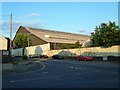
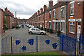
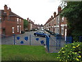
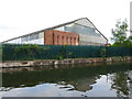
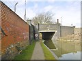
Photos of CV6 5TY


Area Information
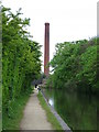
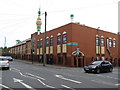
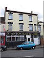
CV6 5TY is a compact residential postcode area in north Coventry, covering 5,732 square metres and home to 1,719 people. Its density—299,917 people per square kilometre—reflects a tightly knit community, though the area’s small size means it is a single cluster of homes rather than a sprawling suburb. Historically part of a rural parish mentioned in the Domesday Book as “Folks Hill,” the area has evolved into a built-up zone centred on Foleshill Road (A444). Today, it is a mix of post-war social housing and older homes, with a population skewed toward adults aged 30–64. The area’s proximity to Coventry’s industrial past is evident in its former factories and canals, though modern life here is defined by local shops, rail links, and the nearby Stanton Bridge Primary School. Living in CV6 5TY means navigating a balance between urban convenience and the remnants of a once-rural landscape, with a community shaped by decades of industrial and demographic change.
- Area Type
- Postcode
- Area Size
- 5732 m²
- Population
- 1719
- Population Density
- 3742 people/km²
The property market in CV6 5TY is characterised by a low home ownership rate—just 25% of residents own their homes—suggesting a strong rental market. The area is primarily composed of houses, which are likely to be older properties built during the post-war period or earlier. This mix of housing stock means buyers should expect a range of property styles, though the small size of the postcode area limits the variety available. The predominance of rental properties may indicate lower affordability for first-time buyers, or a focus on long-term tenancy rather than investment. For those considering purchase, the area’s compact nature means proximity to amenities is a key factor, with homes likely to be in close reach of local shops, schools, and transport links.
House Prices in CV6 5TY
Showing 1 properties
| Address | Type | Beds | Baths | Last Sale Price | Last Sale Date | |
|---|---|---|---|---|---|---|
| Main School Building, Stanton Bridge Primary School, Oliver Street, Coventry, CV6 5TY | commercial | - | - | - | - |
Energy Efficiency in CV6 5TY
Residents of CV6 5TY have access to a range of local amenities within practical reach. The area is served by five retail outlets, including Aldi Edgwick, Morrisons Daily, and the Heart of England Co-operative Co, offering everyday shopping needs. For transport, five railway stations provide connections to Coventry and surrounding areas, while Coventry Airport is nearby for regional flights. Though the area is small, its proximity to Foleshill Road (A444) and historic industrial sites suggests a mix of urban and semi-rural character. The presence of a primary school and social housing estates indicates a community-focused lifestyle, with amenities tailored to daily living rather than luxury. The compact nature of the area means residents are likely to rely on local services, making convenience a key feature of daily life.
Amenities
Schools
The nearest school to CV6 5TY is Stanton Bridge Primary School, which serves the area’s primary education needs. The school is rated “good” by Ofsted, a positive indicator for families seeking reliable education. As a primary school, it caters to younger children, but the absence of secondary schools in the immediate vicinity means students may need to travel to nearby areas for higher education. The presence of a single school suggests a focused, community-oriented approach to education, though families with children requiring secondary schooling should investigate options beyond the immediate postcode. The school’s rating reflects a standard of teaching and facilities that meet expectations, but the lack of diversity in school types may limit choices for expanding families.
| Rank | School | Type | Entry gender | Ages |
|---|
Explore more schools in this area
Go to Schools tabDemographics
The population of CV6 5TY has a median age of 22, but the most common age range is adults between 30 and 64 years. This suggests a community skewed toward working-age individuals, possibly linked to the area’s historical industrial base. Only 25% of residents own their homes, indicating a predominantly rental market, with houses being the primary accommodation type. The predominant ethnic group is White, though the area’s post-World War II history implies a diverse demographic that has shifted over time. The low home ownership rate and presence of older housing stock may reflect economic pressures or a legacy of social housing. For buyers, this means the area is not a traditional owner-occupied neighbourhood, and property values may be influenced by rental demand rather than long-term equity growth.
Household Size
Accommodation Type
Tenure
Ethnic Group
Religion
Household Composition
Age
Household Deprivation
NS-SEC
Explore more demographic insights in this area
Go to Demographics tabPlanning
Planning Constraints
- Flood RiskPremium
- Ramsar Wetland SitesPremium
- Area of Outstanding Natural BeautyPremium
- Protected Nature ReservePremium
- Protected WoodlandPremium