Area Overview for CV6 5TU
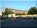
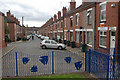
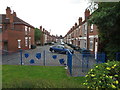
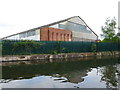
Photos of CV6 5TU


Area Information
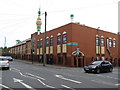
CV6 5TU is a small residential postcode cluster in the north of Coventry, nestled within Foleshill Ward. With a population of 1,719, it reflects a compact, tightly knit community shaped by its historical roots as a former rural parish. The area’s character blends urban development with remnants of its industrial past, including sites once occupied by factories like Courtaulds and Alfred Herbert Ltd. Residents live along roads such as Foleshill Road (A444), with proximity to Coventry’s city centre and transport links. The median age of 22 contrasts with the most common age range of 30-64, suggesting a mix of younger professionals and established families. Daily life here is influenced by the area’s industrial heritage, with nearby rail stations and retail outlets offering convenience. While the population is small, the area’s connectivity to Coventry’s broader infrastructure—via rail, road, and air—makes it appealing for commuters. Its location near Coventry Airport and the historic St Laurence’s Church adds layers of practicality and heritage to living in CV6 5TU.
- Area Type
- Postcode
- Area Size
- Not available
- Population
- 1719
- Population Density
- 3742 people/km²
The property market in CV6 5TU is characterised by a low home ownership rate of 25%, suggesting that most properties are rented rather than owned. This aligns with the area’s history as an industrial and working-class district, where housing stock may have been developed for rental rather than long-term ownership. The accommodation type is predominantly houses, which is unusual for areas with high rental rates, but it may reflect the presence of older, larger homes suited to families. The small size of the postcode area means the housing stock is limited, potentially making it challenging for buyers seeking a wide range of options. For those considering purchase, the low home ownership rate could indicate a competitive market with limited supply, though the availability of houses may cater to specific buyer preferences. The area’s proximity to transport links and industrial sites could also influence property values, with demand driven by commuters or those seeking affordable housing near Coventry’s infrastructure.
House Prices in CV6 5TU
No properties found in this postcode.
Energy Efficiency in CV6 5TU
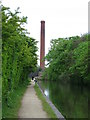
Living in CV6 5TU offers access to a range of amenities within practical reach. The area includes five retail outlets, such as Aldi Edgwick, Morrisons Daily, and Heart of England Co-operative Co, providing convenience for daily shopping needs. For transport, five rail stations—Coventry Arena, Canley, and Bedworth—are nearby, connecting residents to Coventry and beyond. The proximity to Coventry Airport, listed twice in the data, adds to the area’s accessibility for travel. While the data does not mention parks or leisure facilities explicitly, the historical presence of heathland geography in names like Broad Heath and Little Heath hints at potential green spaces. The mix of retail, transport, and proximity to major infrastructure ensures a practical lifestyle, though residents may need to travel slightly further for cultural or recreational amenities. The area’s industrial heritage contrasts with its modern amenities, creating a balance between practicality and historical character.
Amenities
Schools
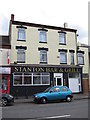
The nearest school to CV6 5TU is Stanton Bridge Primary School, which serves the local community with a primary education offering. The school holds an Ofsted rating of ‘good’, indicating a satisfactory standard of teaching and facilities. While no secondary schools are listed in the data, the presence of a primary school with a positive rating suggests that families may rely on nearby secondary institutions in adjacent areas. The single primary school in the vicinity may mean that students from CV6 5TU travel to other parts of Coventry for secondary education, depending on proximity and school catchment areas. For parents prioritising primary education, the ‘good’ rating at Stanton Bridge Primary School offers reassurance, though the lack of secondary schools within the immediate area could be a consideration for families planning long-term residency.
| Rank | School | Type | Entry gender | Ages |
|---|
Explore more schools in this area
Go to Schools tabDemographics
The demographics of CV6 5TU reveal a community predominantly shaped by middle-aged adults, with 30-64-year-olds forming the largest age group. The median age of 22, however, suggests a younger presence, possibly linked to student populations or recent migrants. Home ownership is low at 25%, indicating that most residents rent their homes, a pattern common in areas with industrial histories and post-war migration. The accommodation type is primarily houses, reflecting a preference for single-family dwellings over flats. The predominant ethnic group is White, though the area’s history as a post-WW2 settlement with industrial employment opportunities may have influenced demographic shifts. The low home ownership rate could indicate economic pressures or a transient population, but it also means rental options are more prevalent. This mix of age groups and housing types creates a dynamic but potentially fragmented community, where the average age of 30-64 suggests a balance between established residents and younger workers.
Household Size
Accommodation Type
Tenure
Ethnic Group
Religion
Household Composition
Age
Household Deprivation
NS-SEC
Explore more demographic insights in this area
Go to Demographics tabPlanning
Planning Constraints
- Flood RiskPremium
- Ramsar Wetland SitesPremium
- Area of Outstanding Natural BeautyPremium
- Protected Nature ReservePremium
- Protected WoodlandPremium