Area Overview for CV6 5TT
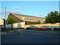
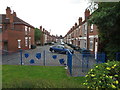
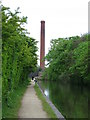
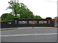
Photos of CV6 5TT


Area Information
CV6 5TT is a small residential postcode cluster in the north of Coventry, part of the Foleshill Ward. With a population of 1,719, it sits along Foleshill Road (A444) and Stoney Stanton Road, blending urban living with remnants of its historic rural past. The area was once a parish mentioned in the Domesday Book, later merging with Coventry. Today, it is a built-up residential and industrial zone, shaped by 19th-century industrial growth and post-war migration. The proximity to Coventry city centre, combined with nearby rail links and retail hubs, makes it accessible yet distinct. Daily life here balances modern convenience with a legacy of manufacturing and weaving industries. While the area has faced historical challenges, including poverty and lawlessness, its current infrastructure—such as rail stations and schools—supports a practical, community-focused lifestyle. Residents benefit from a compact, walkable environment, though the area’s character remains defined by its industrial roots and evolving demographics.
- Area Type
- Postcode
- Area Size
- Not available
- Population
- 1719
- Population Density
- 3742 people/km²
The property market in CV6 5TT is characterised by a low home ownership rate of 25%, suggesting that the area is more rental-focused than owner-occupied. The predominant accommodation type is houses, which may reflect the area’s older housing stock and industrial heritage. This small postcode cluster likely has limited housing diversity, with few new developments to alter the balance. For buyers, the low ownership rate implies competition from renters, potentially limiting availability for purchase. The presence of houses rather than flats or apartments may appeal to those seeking larger living spaces, though the small area size means proximity to Coventry’s broader housing market is key. Investors should consider the local economy’s reliance on industrial and retail sectors, which may influence property demand. The area’s compact size also means that buyers must look beyond CV6 5TT to find a wider range of property types.
House Prices in CV6 5TT
No properties found in this postcode.
Energy Efficiency in CV6 5TT
Residents of CV6 5TT have access to a range of nearby amenities, including five retail outlets such as Aldi Edgwick, Morrisons Daily, and the Heart of England Co-operative Co. These shops provide essential goods and services, supporting daily life with convenience. The area’s rail stations—Coventry Arena, Canley, and Bedworth—offer easy access to Coventry and surrounding regions, enhancing connectivity for commuting and leisure. While no specific parks or leisure facilities are listed in the data, the proximity to Coventry suggests access to larger recreational areas. The retail and transport options indicate a practical, community-focused lifestyle, though the absence of detailed information on green spaces or cultural amenities may require further exploration. The availability of multiple retail and transport points ensures that daily needs are met efficiently, contributing to a functional living environment.
Amenities
Schools
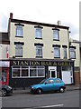
The nearest school to CV6 5TT is Stanton Bridge Primary School, which serves the local community with a primary education offering. The school holds a ‘good’ Ofsted rating, indicating a satisfactory standard of teaching and facilities. As a primary school, it caters to younger children, though families requiring secondary education will need to look further afield. The presence of a rated primary school is a positive for families with young children, providing a local option for early education. However, the lack of secondary schools in the immediate area means that parents may need to consider commuting or enrolling their children in nearby districts. The school’s rating suggests it meets basic educational needs but does not offer exceptional facilities, which may be a consideration for families prioritising high-performing institutions.
| Rank | School | Type | Entry gender | Ages |
|---|
Explore more schools in this area
Go to Schools tabDemographics
The population of CV6 5TT is young, with a median age of 22, though the most common age group is adults aged 30–64. Only 25% of residents own their homes, indicating a rental-dominated market. The area is predominantly composed of houses, reflecting a mix of older properties and newer developments. The predominant ethnic group is White, though the area’s history of post-war migration suggests a diverse demographic evolution. The low home ownership rate may indicate economic pressures or a transient population, but the presence of families in the 30–64 age bracket suggests stability. The area’s character is shaped by its industrial past and the influx of workers and migrants, creating a community with a blend of local and non-local influences. While specific deprivation data is not provided, the 25% home ownership rate and historical context suggest a mix of economic conditions.
Household Size
Accommodation Type
Tenure
Ethnic Group
Religion
Household Composition
Age
Household Deprivation
NS-SEC
Explore more demographic insights in this area
Go to Demographics tabPlanning
Planning Constraints
- Flood RiskPremium
- Ramsar Wetland SitesPremium
- Area of Outstanding Natural BeautyPremium
- Protected Nature ReservePremium
- Protected WoodlandPremium