Area Overview for CV6 5TB
Photos of CV6 5TB


Area Information
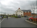
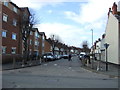
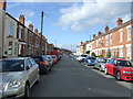
CV6 5TB is a small residential cluster nestled in the north of Coventry, within the Foleshill Ward. With a population of 1,862, it is a compact area characterised by its historical roots and modern-day practicality. Originally a rural parish mentioned in the Domesday Book as “Folks Hill,” the area has evolved into a built-up zone with a strong industrial legacy. Today, it is defined by its proximity to Foleshill Road (A444) and Stoney Stanton Road, serving as a link between Coventry’s city centre and surrounding communities. The area’s character is shaped by its past as a hub for ribbon weaving and manufacturing, with remnants of old factories now repurposed as industrial estates. Despite its small size, CV6 5TB offers a mix of residential living and practical amenities, making it a viable option for those seeking a balance between urban convenience and a touch of historical context. Its location near rail networks and retail hubs adds to its appeal, though its compact nature means buyers should consider nearby areas for broader options.
- Area Type
- Postcode
- Area Size
- Not available
- Population
- 1862
- Population Density
- 9769 people/km²
The property market in CV6 5TB is dominated by houses, with a home ownership rate of 52%. This suggests that while nearly half of properties are owner-occupied, the remaining 48% are likely rented, indicating a mix of private and rental housing. The prevalence of houses over flats or apartments reflects the area’s residential character, though the small size of the postcode means the housing stock is limited. Buyers should consider surrounding areas for a broader selection, as the immediate vicinity offers few alternatives. The market is likely influenced by the area’s industrial heritage, with older properties potentially requiring renovation. For those seeking a family home, the availability of houses may be an advantage, but the compact nature of CV6 5TB means proximity to amenities and transport is critical. Prospective buyers should also weigh the balance between property availability and the need for nearby infrastructure.
House Prices in CV6 5TB
No properties found in this postcode.
Energy Efficiency in CV6 5TB
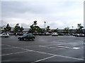
Living in CV6 5TB offers access to essential amenities within practical reach. Retail options include Morrisons Daily, Lidl Edgwick, and Aldi Edgwick, providing everyday shopping convenience. The area’s rail network, with stations such as Coventry Arena and Canley, connects residents to broader transport systems, facilitating travel to work, leisure, or social events. While specific parks or green spaces are not listed, the area’s historical heathland geography—reflected in names like Little Heath—suggests potential for informal outdoor activities. The presence of industrial estates nearby may limit leisure options, but the compact layout ensures that daily needs are met without long commutes. The mix of retail, transport, and historical context creates a lifestyle that balances practicality with a sense of place, though buyers should assess whether the amenities align with personal preferences.
Amenities
Schools
| Rank | School | Type | Entry gender | Ages |
|---|
Explore more schools in this area
Go to Schools tabDemographics
The population of CV6 5TB is predominantly adults aged 30–64, with a median age of 47. This suggests a community of established professionals and families, though the area’s home ownership rate of 52% indicates a mix of owner-occupied properties and rental homes. The accommodation type is primarily houses, which aligns with the area’s residential character. The predominant ethnic group is Asian, reflecting a demographic profile shaped by post-war migration patterns. This diversity influences the social fabric, with community dynamics likely centred on shared cultural practices and local institutions. The age distribution and home ownership figures suggest a stable, long-term resident base, though the relatively low ownership rate (compared to national averages) may indicate a reliance on rental housing. The absence of specific deprivation data means quality of life assessments must be inferred from broader contextual factors, such as access to amenities and transport links.
Household Size
Accommodation Type
Tenure
Ethnic Group
Religion
Household Composition
Age
Household Deprivation
NS-SEC
Explore more demographic insights in this area
Go to Demographics tabPlanning
Planning Constraints
- Flood RiskPremium
- Ramsar Wetland SitesPremium
- Area of Outstanding Natural BeautyPremium
- Protected Nature ReservePremium
- Protected WoodlandPremium