Area Overview for CV6 5HB
Photos of CV6 5HB
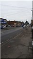
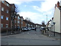
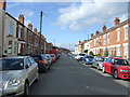


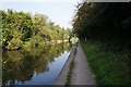
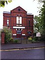
92 photos from this area
Area Information
Key information about the CV6 5HB including its size, population, and administrative classification.
- Area Type
- Postcode
- Area Size
- 6000 m²
- Population
- 1590
- Population Density
- 9148 people/km²
House Prices in CV6 5HB
41
Properties
£92,929
Average Sold Price
£67,000
Lowest Price
£146,000
Highest Price
Showing 41 properties
| Address | Type | Beds | Baths | Last Sale Price | Last Sale Date | |
|---|---|---|---|---|---|---|
| 119 Crabmill Lane, Coventry, CV6 5HB | Terraced | 2 | 1 | £146,000 | Jun 2025 | |
| 121 Crabmill Lane, Coventry, CV6 5HB | Terraced | 2 | 1 | £120,000 | Jan 2020 | |
| 75 Crabmill Lane, Coventry, CV6 5HB | house | 2 | - | £67,000 | Feb 2013 | |
| 79 Crabmill Lane, Coventry, CV6 5HB | house | 2 | - | £73,000 | Apr 2010 | |
| 77 Crabmill Lane, Coventry, CV6 5HB | Terraced | 2 | 1 | £72,500 | Apr 2009 | |
| 83 Crabmill Lane, Coventry, CV6 5HB | Terraced | - | - | £86,000 | Feb 2006 | |
| 123 Crabmill Lane, Coventry, CV6 5HB | Terraced | 2 | 1 | £86,000 | Sep 2005 | |
| 1, St Nicholas Court, 87-107 Crabmill Lane, Coventry, CV6 5HB | Land | 1 | - | - | - | |
| 85 Crabmill Lane, Coventry, CV6 5HB | house | - | - | - | - | |
| 73 Crabmill Lane, Coventry, CV6 5HB | house | - | - | - | - |
Page 1 of 5
Energy Efficiency in CV6 5HB
Amenities
Schools
| Rank | School | Type | Entry gender | Ages |
|---|
Explore more schools in this area
Go to Schools tabDemographics
Household Size
One person
most common
Accommodation Type
Houses
most common
Tenure
23
majority
Ethnic Group
White
most common
Religion
N/A
most common
Household Composition
N/A
most common
Age
47
median
Adults (30-64 years)
most common
Household Deprivation
N/A
with no deprivation
NS-SEC
10
in Lower managerial occupations
Explore more demographic insights in this area
Go to Demographics tabPlanning
Planning Constraints
- Flood RiskPremium
- Ramsar Wetland SitesPremium
- Area of Outstanding Natural BeautyPremium
- Protected Nature ReservePremium
- Protected WoodlandPremium