Area Overview for CV6 5FY
Photos of CV6 5FY
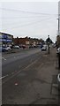
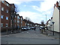
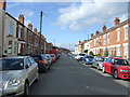


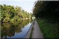
92 photos from this area
Area Information
Key information about the CV6 5FY including its size, population, and administrative classification.
- Area Type
- Postcode
- Area Size
- 3882 m²
- Population
- 1360
- Population Density
- 5329 people/km²
House Prices in CV6 5FY
23
Properties
£109,600
Average Sold Price
£85,000
Lowest Price
£130,000
Highest Price
Showing 23 properties
| Address | Type | Beds | Baths | Last Sale Price | Last Sale Date | |
|---|---|---|---|---|---|---|
| 675 Stoney Stanton Road, Coventry, CV6 5FY | house | - | - | £130,000 | Jan 2023 | |
| 677 Stoney Stanton Road, Coventry, CV6 5FY | Terraced | 2 | - | £121,000 | Jun 2021 | |
| 679 Stoney Stanton Road, Coventry, CV6 5FY | Terraced | 2 | - | £115,000 | Apr 2020 | |
| 689 Stoney Stanton Road, Coventry, CV6 5FY | house | - | - | £97,000 | Jan 2018 | |
| 657 Stoney Stanton Road, Coventry, CV6 5FY | house | - | - | £85,000 | Nov 2004 | |
| 643A Stoney Stanton Road, Coventry, CV6 5FY | Semi-detached | 3 | - | - | - | |
| Flat, 671 Stoney Stanton Road, Coventry, CV6 5FY | Terraced | - | 1 | - | - | |
| Flat, 645 Stoney Stanton Road, Coventry, CV6 5FY | Flat | - | - | - | - | |
| Flat Above, 659 Stoney Stanton Road, Coventry, CV6 5FY | Flat | - | - | - | - | |
| Flat Above, 667 Stoney Stanton Road, Coventry, CV6 5FY | Flat | - | - | - | - |
Page 1 of 3
Energy Efficiency in CV6 5FY
Amenities
Schools
| Rank | School | Type | Entry gender | Ages |
|---|
Explore more schools in this area
Go to Schools tabDemographics
Household Size
Family (3-5 people)
most common
Accommodation Type
Houses
most common
Tenure
32
majority
Ethnic Group
White
most common
Religion
N/A
most common
Household Composition
N/A
most common
Age
47
median
Adults (30-64 years)
most common
Household Deprivation
N/A
with no deprivation
NS-SEC
15
in Lower managerial occupations
Explore more demographic insights in this area
Go to Demographics tabPlanning
Planning Constraints
- Flood RiskPremium
- Ramsar Wetland SitesPremium
- Area of Outstanding Natural BeautyPremium
- Protected Nature ReservePremium
- Protected WoodlandPremium